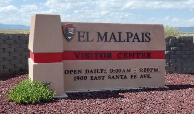
 Our third NM in New Mexico was El Malpais National Monument. El Malpais means “the badlands” and they were bad in the best possible way!
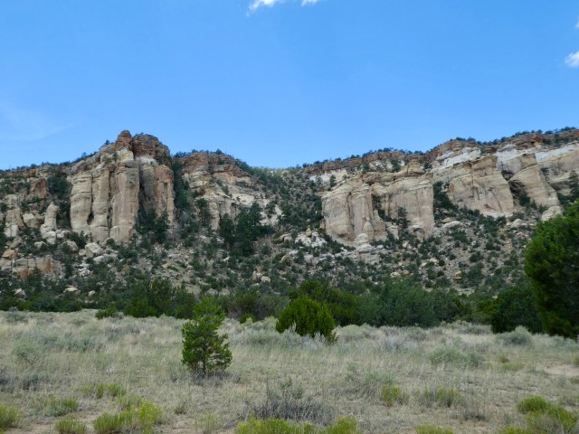
Entering the monument on the east side, we saw sandstone bluffs.

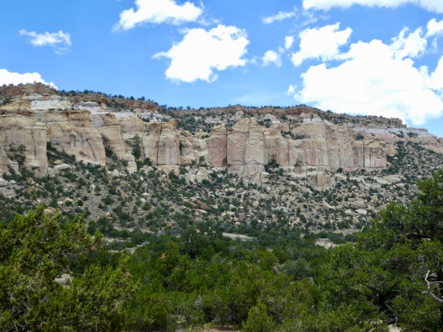
There were interesting geologic breaks in these bluffs, vertical and horizontal.
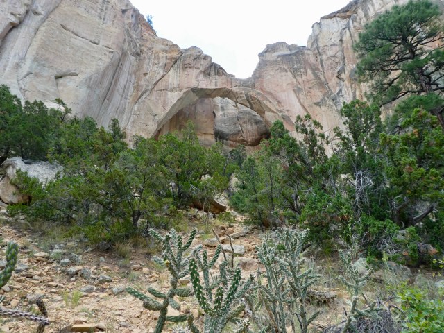
The La Ventana Arch is within the monument.
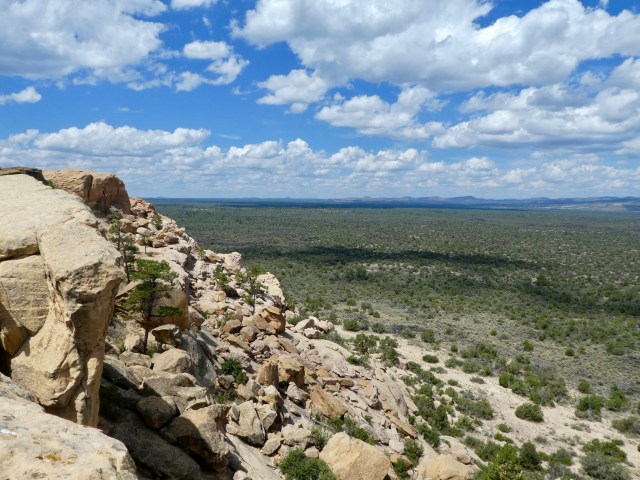
The dominant feature of El Malpais is the lava flow generated from McCarty’s Crater 3900 years ago. From the height of the sandstone bluffs, the flow looks deceptively green.
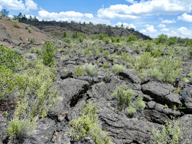
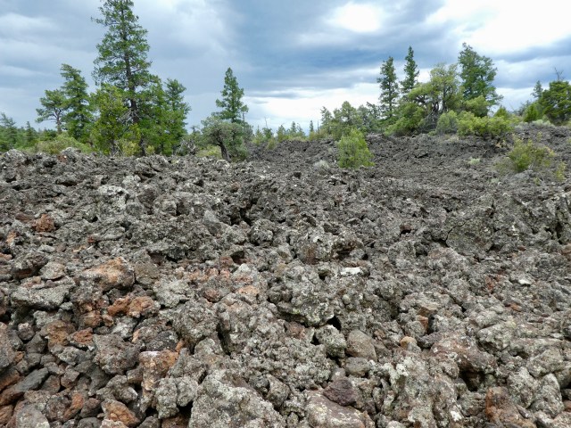
On the ground the black lava is clearly dominant.
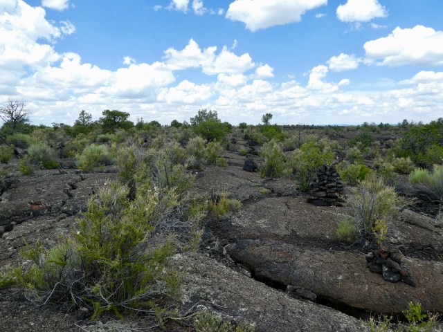
There was a trail through the lava flow marked with cairns.
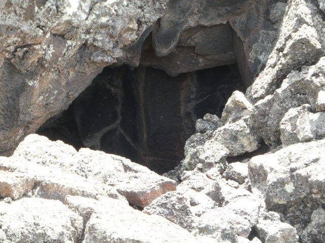
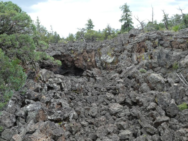
There were little caves or collapsed lava tubes here and there. From a distance we thought these were petroglyphs. They were not – just staining on the rock.
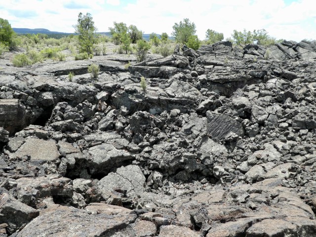
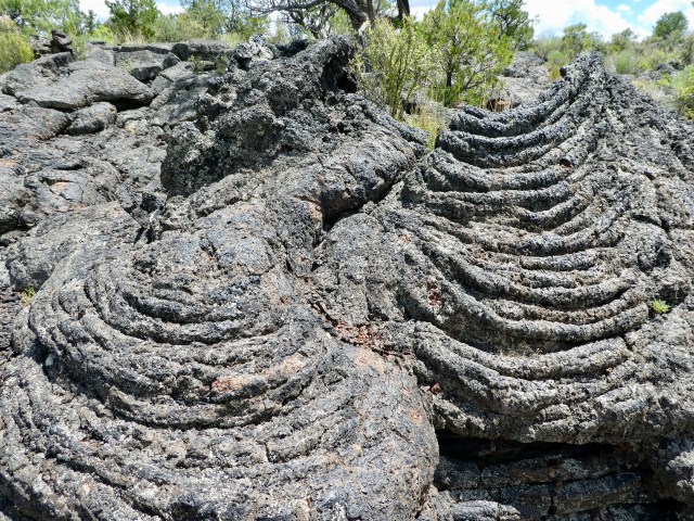
The lava looked different at every turn.
Recent lava activity in Hawaii has helped scientists understand what happened at El Malpais.

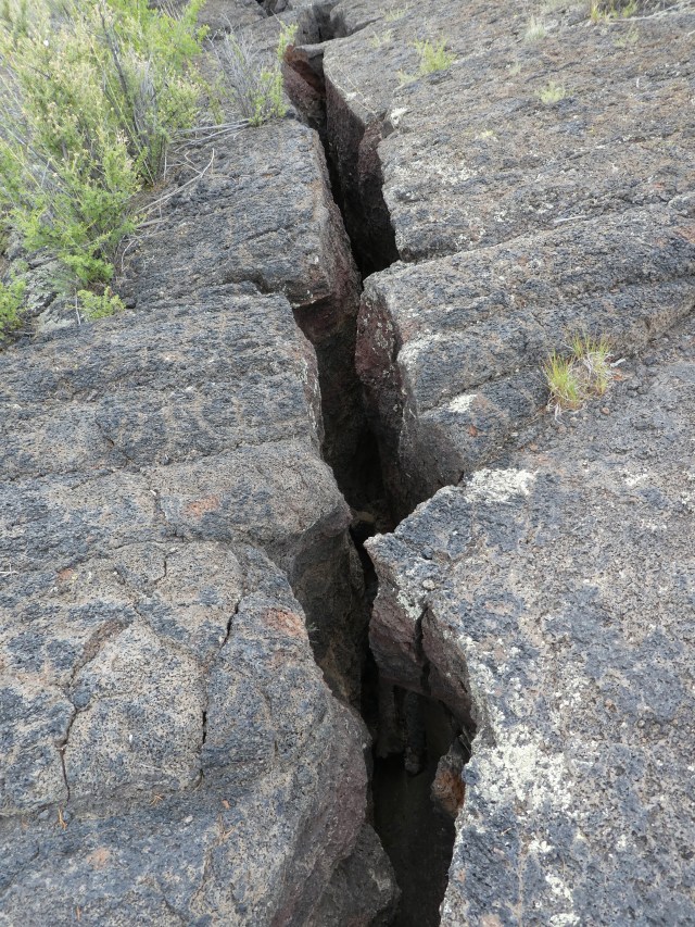
We walked over many crevices some where we could see the bottom and some we could not! They fit together like puzzle pieces.
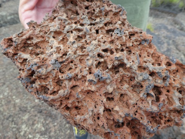
This lava rock was surprisingly light.
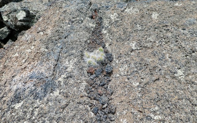
A cactus makes a claim for life in the lava environment.
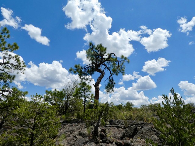
A forest of small Douglas Fir and Piñon Pine exists on the lava flow. As the roots twist to find their way in the lava, the top of the tree twists too.
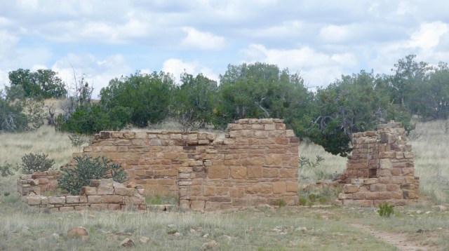
People made their homes in and around the lava flows as well. There were ancestral Puebloans in the area in the 1100 and 1200s but this is not a Puebloan ruin. The monument holds two abandoned homesteads from far more recent days. This is the remnants of the Garrett Homestead, thought to have been built between 1935-37. Homesteaders escaping the dust bowl amid the Great Depression tried to eek out a life in this difficult land.
El Malpais National Monument also has lava tubes and ice caves accessible with a permit but we did not have the needed equipment. That’s a downside of owning a house – some of our stuff was there instead of with us.
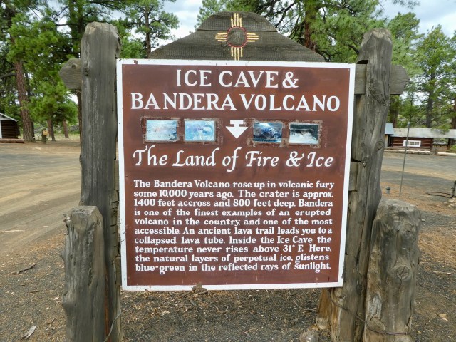
In the vicinity, but outside the monument, we explored the Ice Cave – Bandera Volcano, The Land of Fire and Ice.
 The site is privately owned, originally purchased for raising sheep. That is hard to imagine. The same family maintains ownership and is now in its second generation as a tourist site.
 This is a spattercone, formed when a minor vent formed in the molten lava. A surge of air rushed through the lava breaking the surface and forming a blow hole.
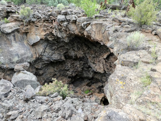
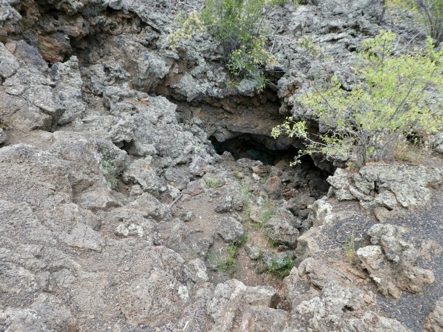
A section of collapsed lava tube.
This lava tube still goes somewhere….but we didn’t go see where.
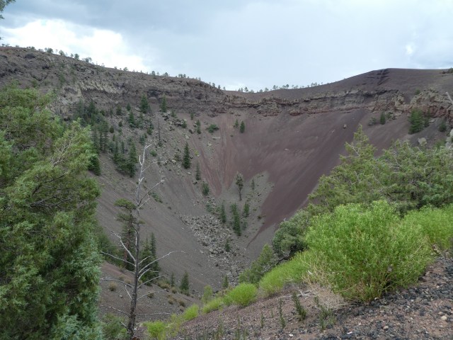
We walked up to the viewing area for the Bandera Crater, the largest volcano of many in the area. Bandera last erupted 10,000 years ago. The crater is 1400 feet wide and 800 feet deep.
Okay, this was the fire – let’s find the ice!
This small ice cave was used for food storage when the family first purchased the site.

We descended down a lot of stairs to the opening of the main ice cave. I couldn’t help but think about going back up all those stairs.

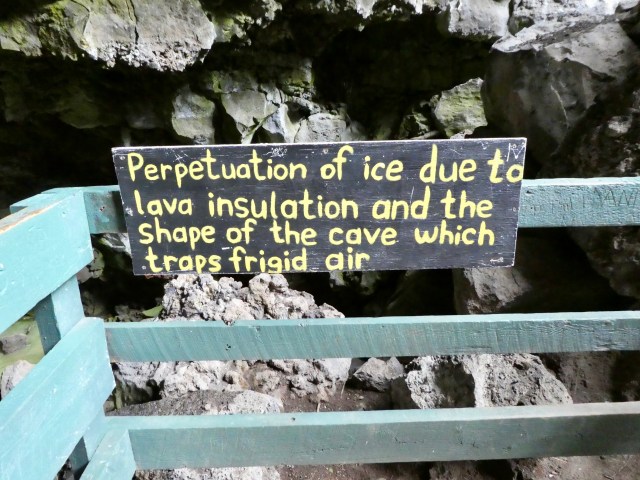
As we approached this platform we could really feel the temperature change. The cave is a consistent 31 degrees and made our warm day feel wonderfully cool!

The ice and icicles visible from the opening of the cave.
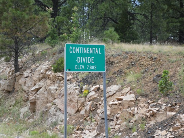
It always seems worth noting when we cross the Continental Divide! We crossed it from east to west going from El Malpais to Bandara Volcano and then again from west to east heading back to Grants, New Mexico.
One NM in NM to go!


We visited/blogged here in Sept. 2017. In fact, some of your pictures look exactly like my pictures! I think I took a million pictures of the lava flow because every one looked different. I thought the ice cave was pretty unbelievable. Looks like you had a wonderful vacation. What’s next?
El Morro. I liked all four of these for different reasons. National monuments are preserved for a reason!
As always it is so interesting reading about your travels. Thanks for taking us along on your adventures.
When we were their I recall it was pretty toasty hiking out on the lava. What an interesting area!
How interesting, thanks for sharing.