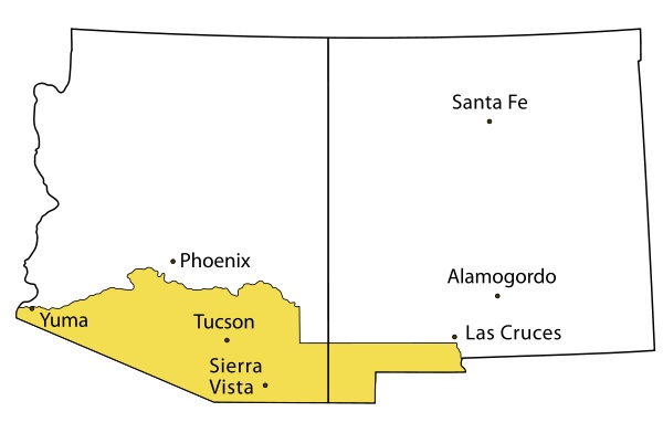
With Randy growing up in Tucson, and with all the traipsing around we’ve done, there was still a part of Arizona we had neglected. We finally went to the place that is “so God awful far away from everything.” You’ll hear more about the woman who spoke those words later in the blog. For now, know that we traveled to the southeast corner of Arizona, close to the borders with Mexico and New Mexico.
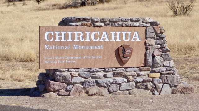
We visited the Chiricahua National Monument, established in 1924.
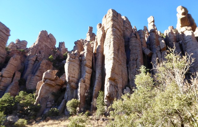
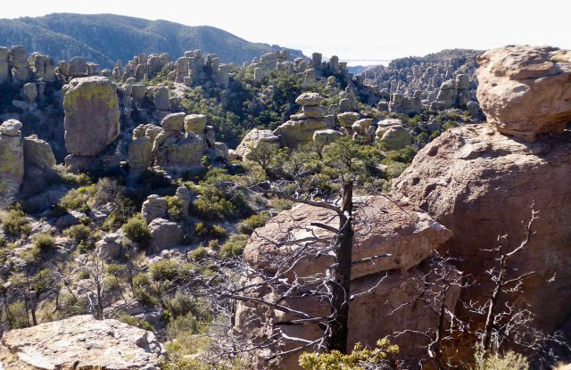
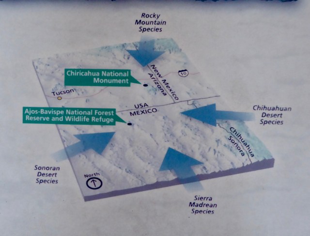 The area is a geologic four corners. Four ecosystems meet in the Chiricahua Mountains including the Chihuahuan Desert, The Sonoran Desert, The Rocky Mountains and the Sierra Madre Mountains.
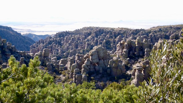 Geologists call the area a sky island because it is an isolated mountain range surrounded by a grassland sea. Created by volcanic ash, continental lift, water, ice and erosion, the pinnacles are beautiful! The Chiricahua Apache called the mountain pinnacles “standing up rocks.”
 The Chiricahua Apache lived in the area for hundreds of years. They mostly avoided the Spaniards but bitter warfare erupted with the Mexicans when they owned Apache native lands.
The United States acquired the land by means of the 1854 Gadsden Purchase with intent to facilitate shipping by constructing a deep southern transcontinental railroad route. The purchase also reconciled border issues with Mexico.
The Apache were a roaming people. The Chiricahua band, led by Cochise, lived peaceably with their white neighbors. 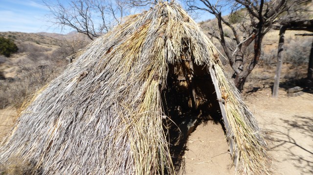
These Apache homes were easy to recreate when it was time to move on.
John Butterfield established an Overland Mail Route that went through Apache Pass. It operated for three years, ending as the Civil War began.
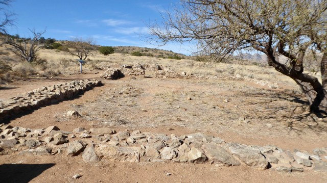
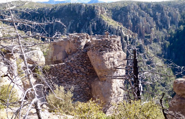
These are the remains of the Butterfield Stage Stop at Apache Pass.
A portion of the 2800 mile Butterfield route remains. In three years the Overland Mail group was attacked by Apache only once and the mail was late only three times.
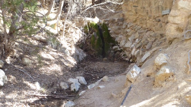
The Apache and stage station operators shared the only consistent fresh water spring in the area.
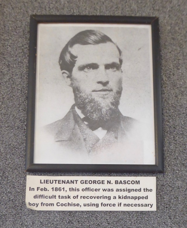 In an 1861 incident known as The Bascom Affair, brash young Lt. Bascom was sent to the Apache Pass area to rescue a Mexican boy and return some stolen cattle. He mistakenly believed Cochise responsible and held him and his party hostage until the boy and cattle were to be returned. Cochise escaped but others in his party were subsequently killed. The incident sparked open warfare for eleven years.
In 1862, the Apache ambushed troops which led to the establishment of Ft. Bowie. It served as a hub for military campaigns between 1862 and 1886.
Cochise made peace with the white men in 1872 and negotiated a reservation that included Chiricahua Apache traditional homelands.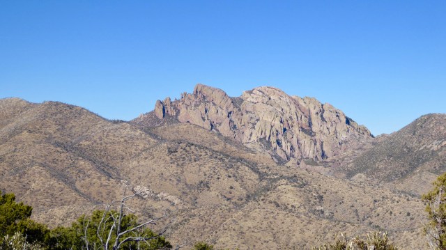
No photographs of Cochise exists, but this formation is thought to be Cochise at rest in his native land.
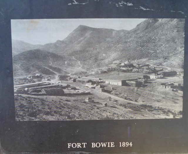
After Cochise’ death, young Apache men grew discontent on the reservation which lead to the rise of Geronimo. Geronimo and his followers finally surrendered in 1886, and were held at Ft. Bowie before being taken into exile in Florida. Ft. Bowie was decommissioned in 1894.
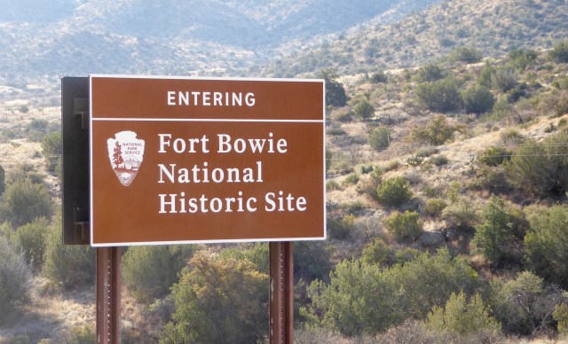
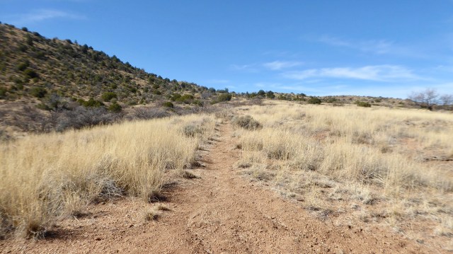
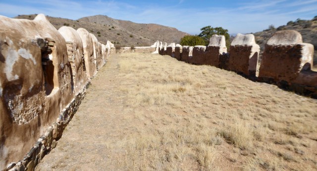
We walked into what remains at Ft. Bowie after meeting a ranger for a 1.5 mile hike and tour through Apache Pass.
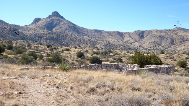
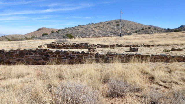 There are remains of many of the buildings, some with a limestone covering to prevent further deterioration.
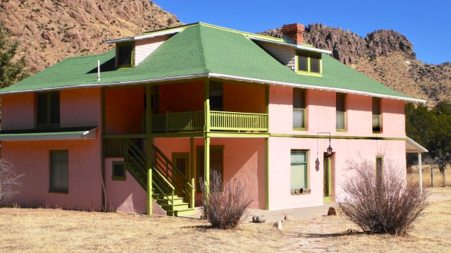
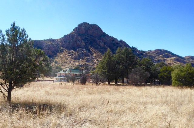 Better preserved is the former home of a young Swedish American soldier from Ft. Bowie, Neil Ericcson and his wife Emma. After his service, Neil and his wife moved the short distance into the mountains. They raised three daughters on their land eventually starting a guest house so people could enjoy the “Wonderland of Rocks.”
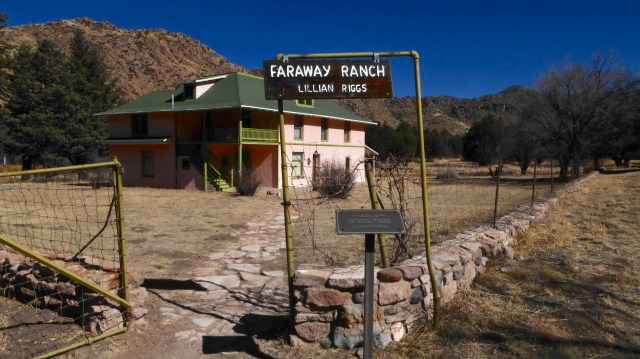 Their eldest daughter Lillian and her husband Ed Riggs eventually became the guest keepers. Lillian named it FarAway Ranch because it was ‘so God awful far away from everywhere.’
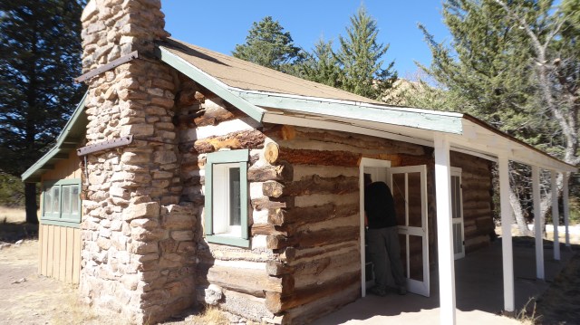
The nearby Stafford Cabin, built in 1880, was purchased and renovated for additional guest quarters.
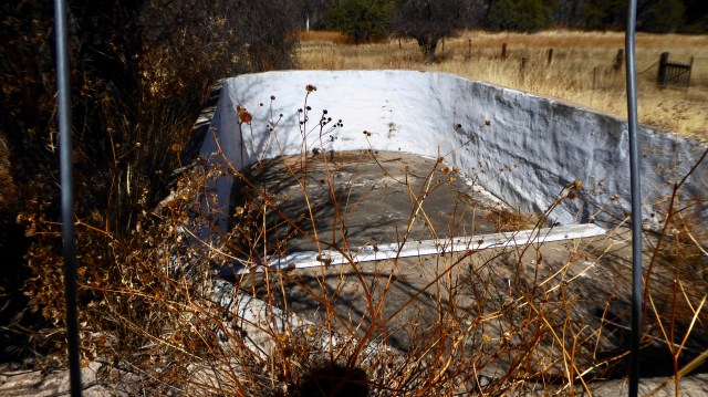
It was “God awful far away”, but there was still a swimming pool!
Ed Riggs was instrumental in the area becoming a national monument in 1924.
The CCC were here during the 1930’s and built roads and trails.
 We weren’t able to go inside the guest house as tours are available only on weekends but that is just incentive to go back someday! There is a trail called Echo Pass we plan to explore (Elko wasn’t allowed) so we’ll do that too. Having waited so long to visit the Land of Standing Rocks the first time, we aren’t likely to wait so long again.


Thanks for sharing the history and wonderful pictures of this part of Arizona. Did you do this on a day trip out of Tucson or move closer to the area?
We went out of Willcox which worked well. Our fifth wheel is too big for the campground at the monument.
Southeastern Arizona is a favorite part of the world for us. But it is a long ways from most things. The first time we visited the National Monument we did it from the east side (Rodeo, NM) over forest service roads. Miles and miles (and miles) of washboard. Not a good idea…
Glad that you’re getting a chance to explore that area some.
We had about 8 miles of dirt road to the trailhead at Ft. Bowie. It wasn’t a bad road but we still have a lot of dust in the truck. There is still so much to explore in southeast AZ that we haven’t done, makes volunteering at Kartchner Caverns even more appealing.
This is a beautiful area. We really enjoyed it. I think we were the only ones in the National Monument when we visted. Great blog of the history of the area.
Thank you for creating a written picture of the history and area. Your article has inspired the desire to visit this area.
Thank you Denise. There is no greater compliment you could have given me. We can’t wait to go back.
Great article – very thorough. We were there last year and loved it. Not too Gawd-awful far away from there is the Twin Buttes RV park – right between Douglas and Bisbee. I would highly recommend it for anyone in the area.
Good to know. We plan to go back sometime because we didn’t even get down that far. Such a treasure trove of interesting places out there in the boonies!