Leaving Page, we headed west toward the North Rim of the Grand Canyon, a place we have wanted to visit for years.
We have been to the south rim frequently as it is far easier to get to. The south rim is where most Grand Canyon visitors go. True story: Randy, a girlfriend, and I went camping on the south rim of the Grand Canyon the night we first met at Northern Arizona University in 1977. My mother didn’t hear that story until 30 years later!
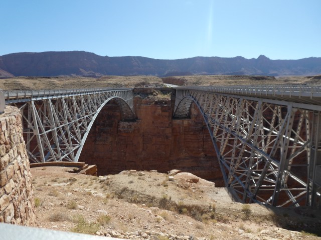 En-route we came upon the Navajo Bridges. The bridge on the left is the original, built in 1928. It is now a walking path spanning the Colorado River.
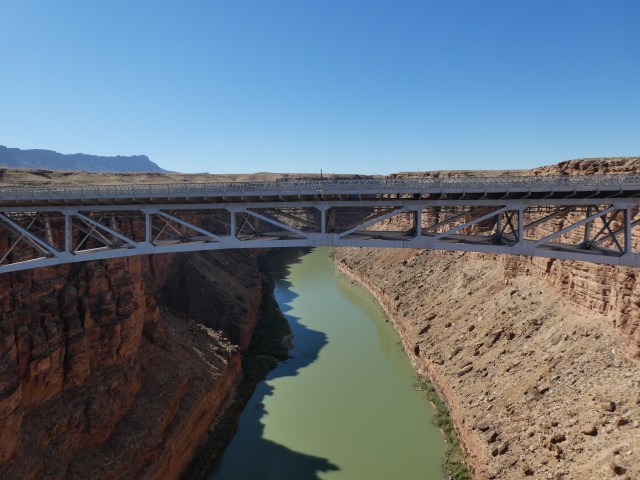 A second, very similar looking bridge, was built for modern vehicles and traffic, in 1995.
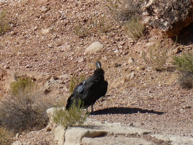 California Condors frequent and nest in the Navajo Bridge area and we were delighted to see one near the bridge footings. Notice the tag on the right wing. Condors weigh up to 23 lbs, have an average wingspan of 9.5 feet and are the largest land bird in North America. They can fly 80 miles per hour! In 1982 there were 22 known California Condors, now there are approximately 500!
 Further down the road we came to the “Arizona Strip,” where six condors were released by the Peregrine Fund in 1996. Condors had not been been seen in Arizona since 1900. Since that initial release, the Peregrine Fund has released an additional 8-10 condors annually.
 Adjacent to the condor placard was one about Sharlot Hall. She was important in Arizona history in a variety of ways. The placard highlighted her campaign to ensure that Arizona got separate statehood status. In 1906, she opposed a congressional measure to bring New Mexico and Arizona into the Union as one state. She toured the territory gathering opposition to the bill and wrote a poem describing why Arizona deserved separate statehood. The poem was delivered to US congressman and the measure was defeated, maybe in part, because of her efforts.
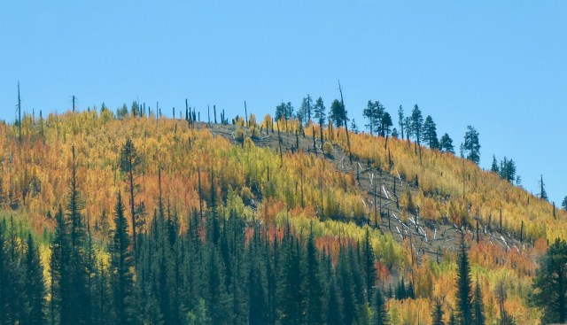 We had a beautiful fall drive approaching the north rim of the Grand Canyon.
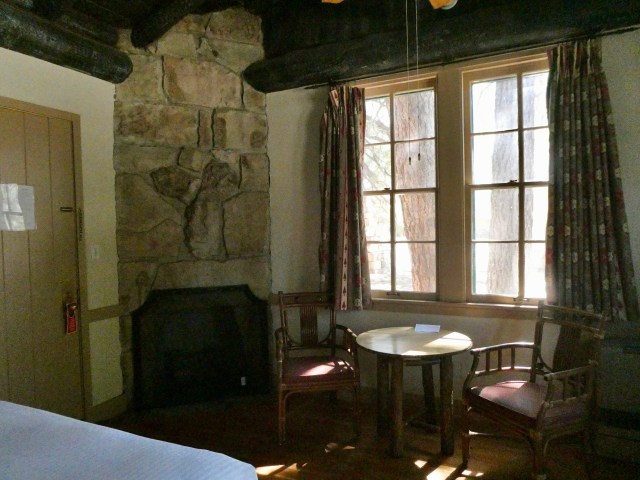
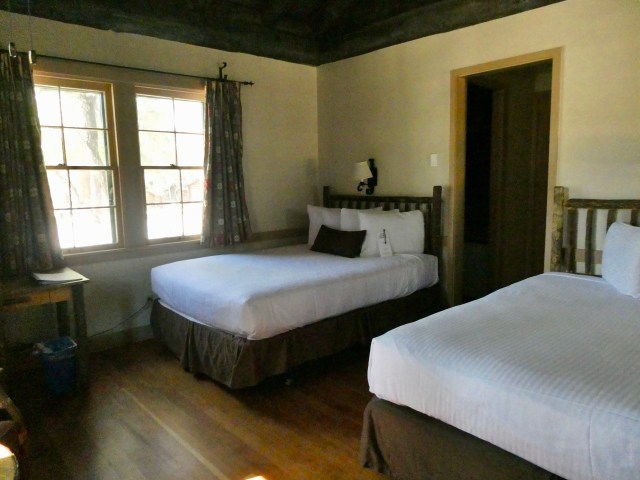
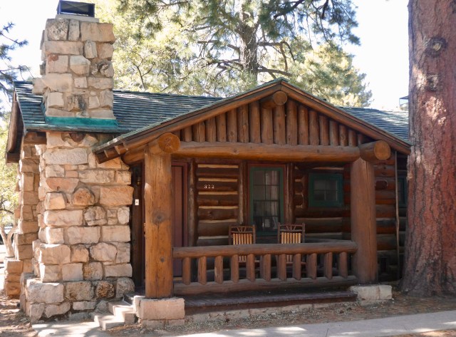 We were delighted with our little cabin, inside and out!
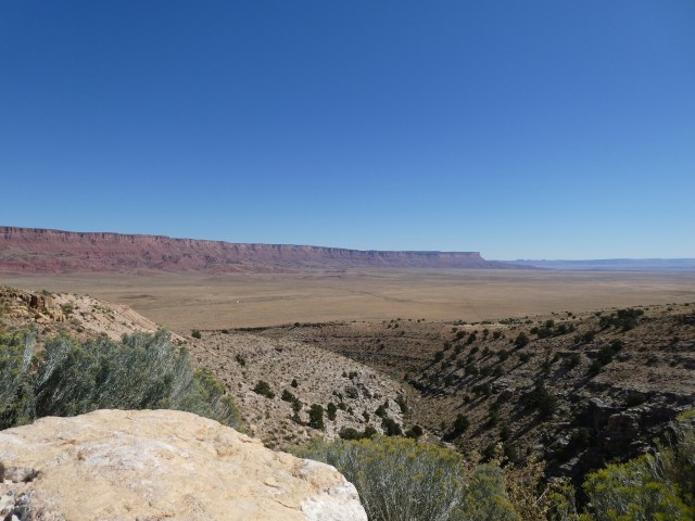
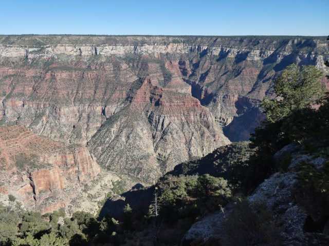
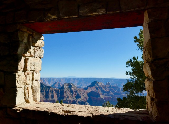
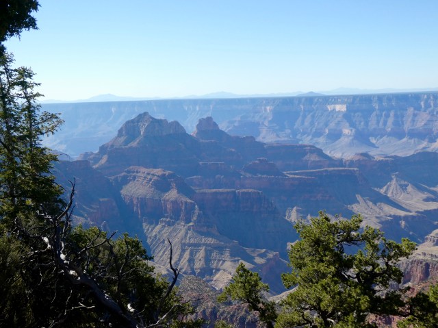
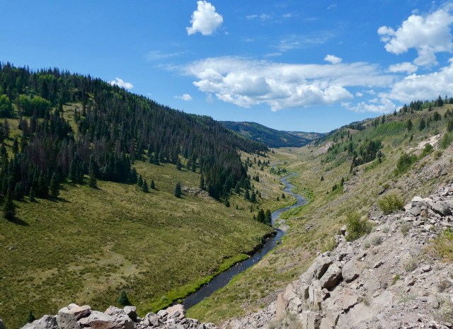
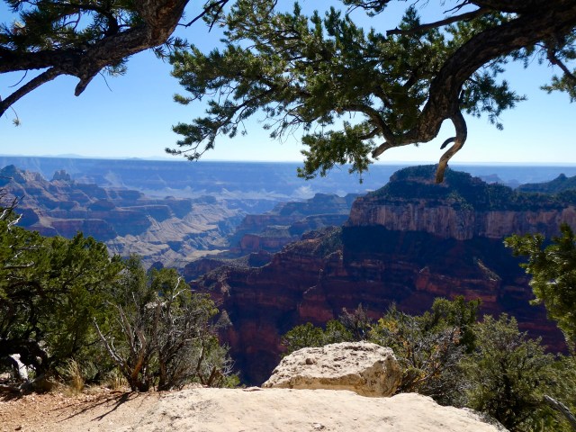 Although the day was a bit hazy, we enjoyed views of the north rim!

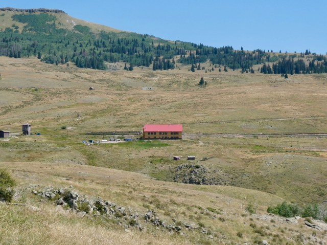
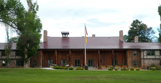
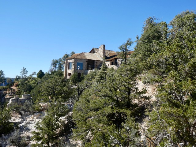 The Grand Canyon Lodge was built on the edge of the north rim.
 We enjoyed the warm sun on the lodge verandah.
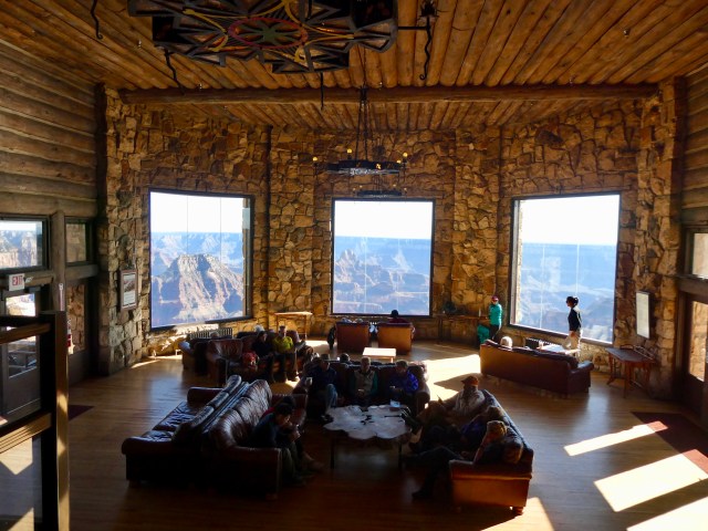 There were views everywhere, including inside the lodge lobby.
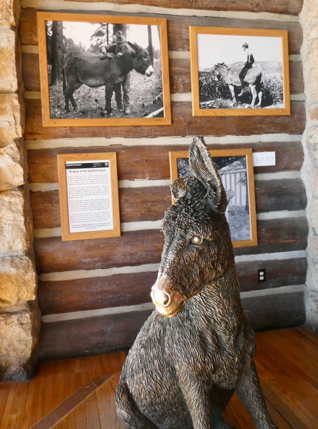 We learned about Brighty, the burro. Burros had been brought to the canyon area by miners and were eventually abandoned. They survived over time. Brighty became a pet of the first lodge owner in 1917. Brighty and family son Bobby worked together hauling water and Brighty received daily flapjacks. Eventually the National Park Service decided to remove wild burros and most were captured and adopted out by 1981.
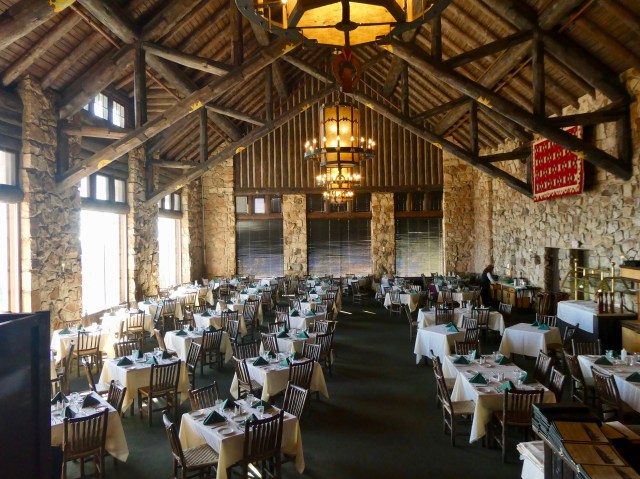 We ate in the lodge dining room, one of several places to eat on site.
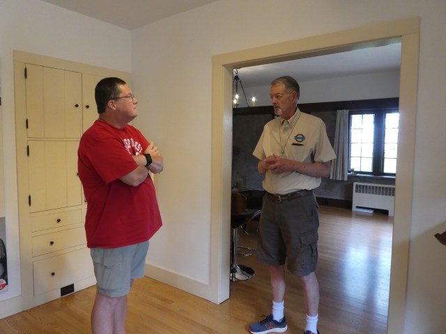
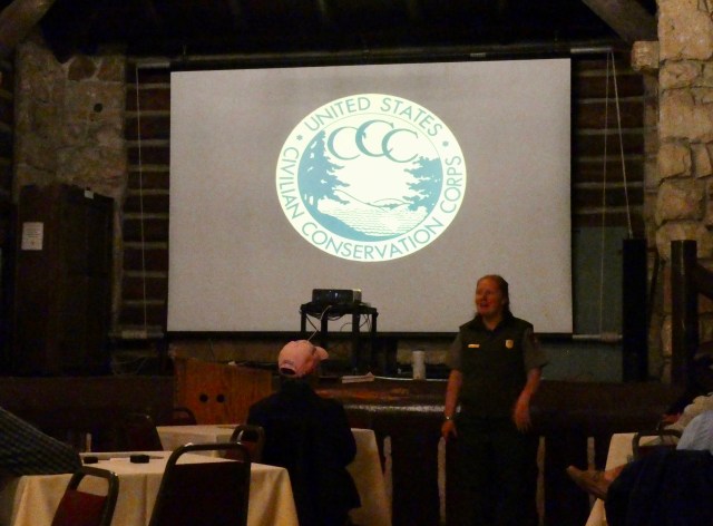 We attended a ranger presentation on the Civilian Conservation Corps. It was one of the best we’ve ever attended.
 A view from one of the CCC sites.
 The next morning we walked the rim trail one more time looking at the views and trying to find a Kaibab Squirrel. We learned Kaibab Squirrels live only in this area and we wanted to see one. Supposedly they are everywhere but we had quite a challenge finding one! We were searching for a gray squirrel with a white tail….
 We saw and heard evidence of this one long before Randy finally found it way up in the tree. The zoom lens and his steady hand got the picture!
 After all that effort, we saw this one bounding away as we approached our truck to leave.
Our take away is that we like the north rim very much. Even though it is a bit of a challenge to get there, we were surprised by the amount of visitors and activity. A lot of people like the North Rim of the Grand Canyon! We hope to visit again soon.
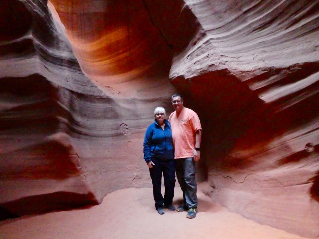
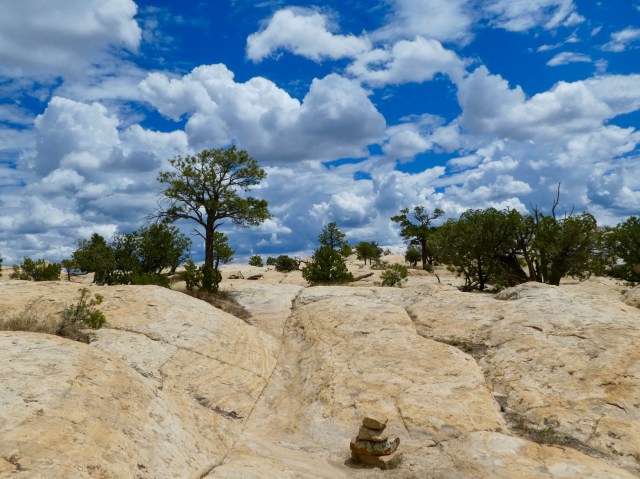
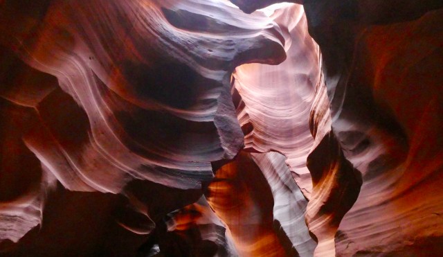 Even if you are unaware, you have likely seen photographs of Antelope Canyon near Page in northern Arizona.
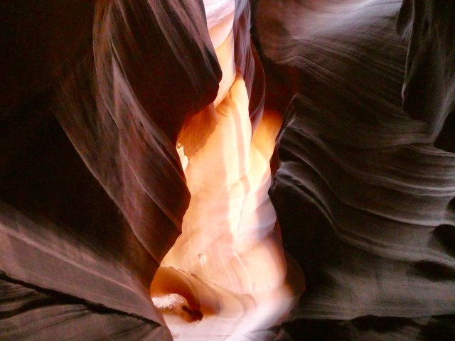 Antelope Canyon was formed by flash flooding through Navajo Sandstone.
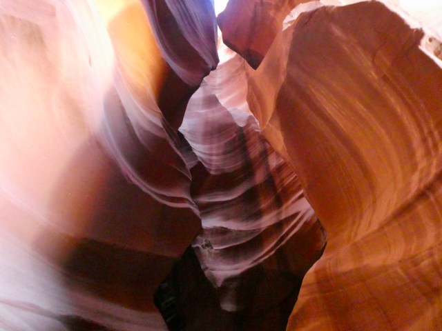 The first problem we encountered with Antelope Canyon was whether to book (well in advance) an Upper or Lower Canyon tour.
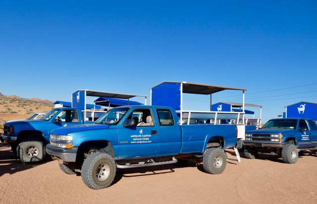 We were transported to the site in four wheel drive vehicles.
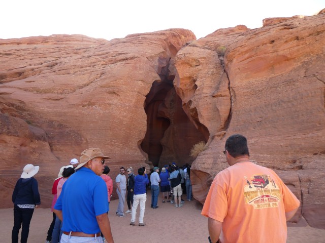 An interesting entrance to the Upper Canyon – walk right in!
 There are about 12 people in a tour group, but there are dozens of tours in the canyon at the same time.
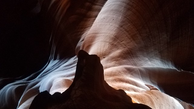 The tour guides are awesome, knowing just where and at what angle, to take photographs. Some of the views have been named to reflect something similar outside the canyon.
 We enjoyed our tour so much that we inquired about a walk up tour for the Lower Canyon. (We had seen limited “cash only” walk up opportunities at the Upper Canyon.)
 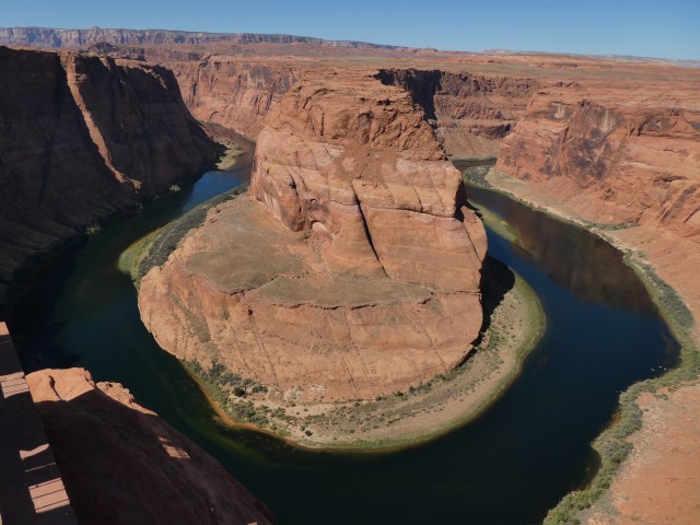 With hours to wander, we ventured to other sites near Page.
  Then we went to Antelope Point Marina and enjoyed a boat tour of this section of Lake Powell.
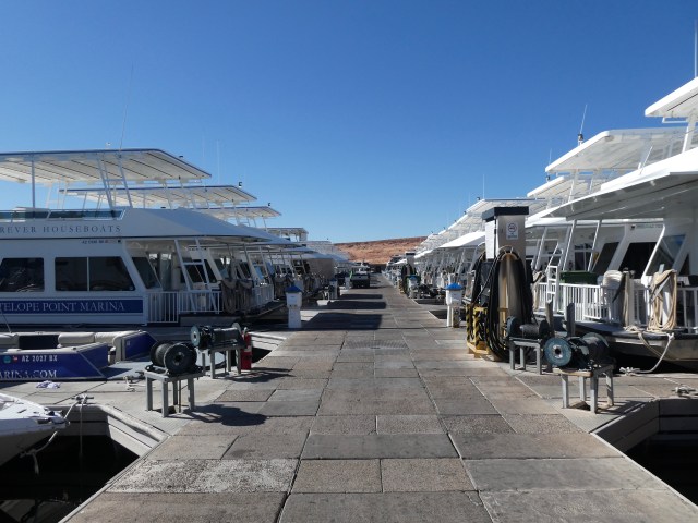 We enjoyed three house boat vacations on Lake Powell many years ago and, while at the marina, decided to take a look inside the new houseboats available for rent.
 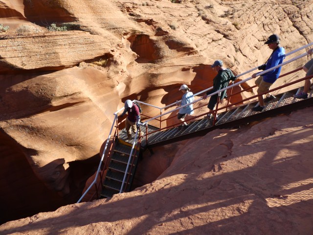 At 4:00 we connected with our tour guide.
 There were sets of stairs throughout the tour which could be problematic for some.
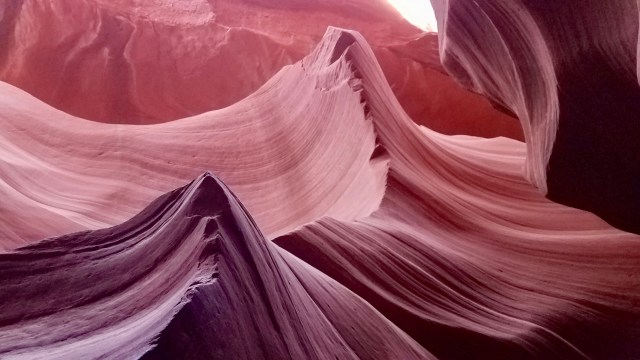 There are so many interesting features in the sandstone.
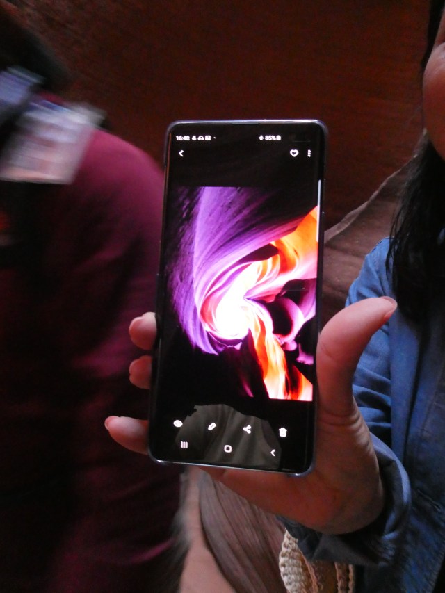 Like before, our tour guide knew when and how to get the best pictures, mostly with cell phones.
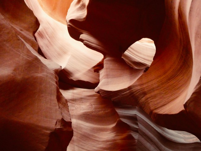 One “photography tour” is offered each day, presumably allowing more time at the best time of the day for light angles.
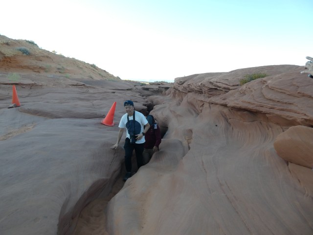
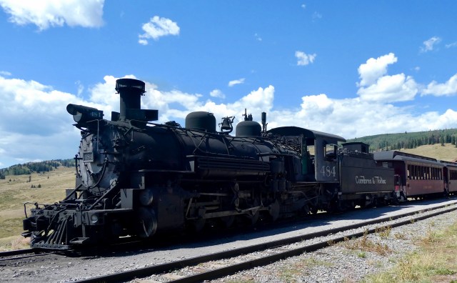 We enjoy riding old trains and have been on quite a few including the Durango to Silverton trip I wrote about in
  The Cumbres & Toltec is advertised as the longest and highest narrow gauge railroad in America. Narrow gauge lines are 3 feet wide instead of the standard 4 feet 8 inches.
 The Cumbres & Toltec is a remnant of the Denver & Rio Grand Railway, built in 1881 for the mining industry in southwest Colorado.
 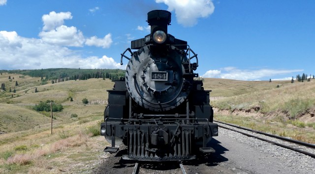 Colorado and New Mexico joined together, contracting with Cumbres Toltec Operating LLC and the Friends of Cumbres & Toltec Scenic Railroad, Inc. to operate a tourist train.
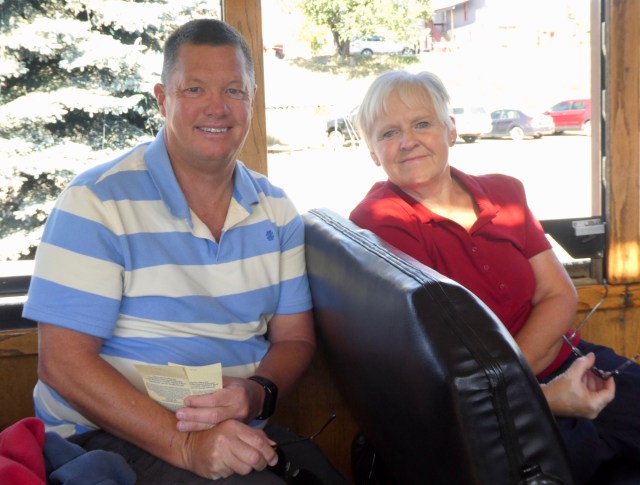
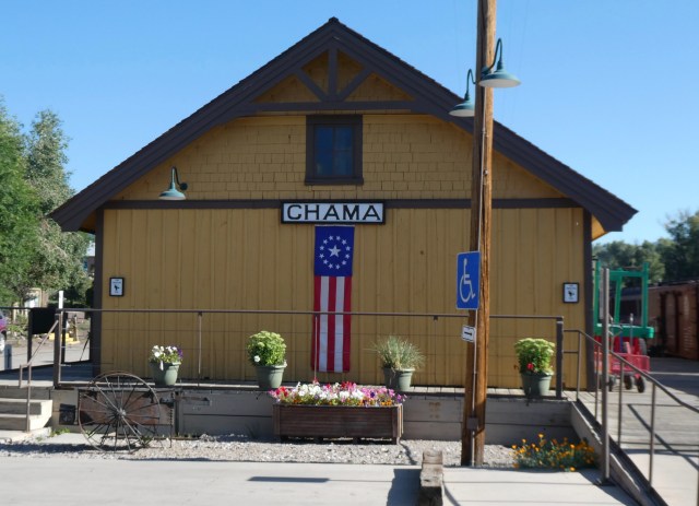 We began our train ride in Chama, New Mexico with tickets to ride the complete 64 mile route arriving in Antonita, Colorado. We would return to Chama by motor coach.
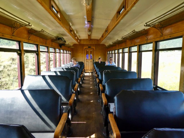
 Movie personnel utilized the train and this area while filming Indiana Jones and the Last Crusade.
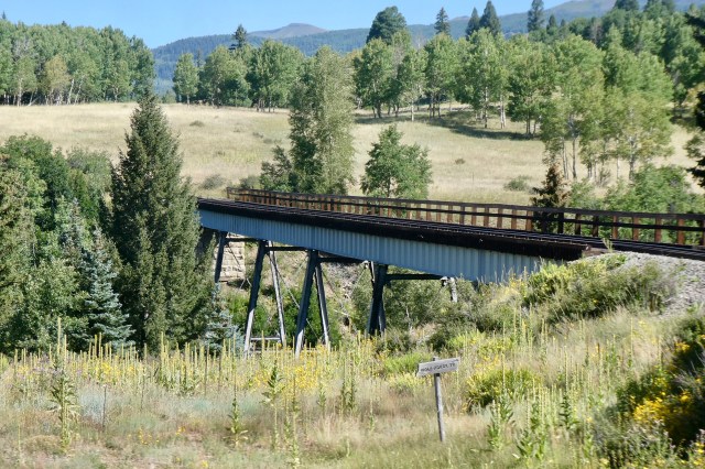 Lobato Trestle sits 100 feet above Wolf Creek.
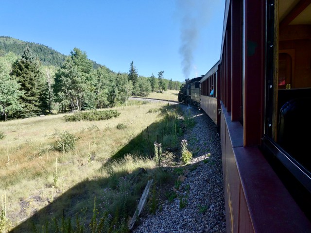
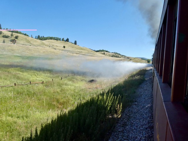 The engineer is doing a blowdown – releasing steam to adjust pressure and eject sediment.
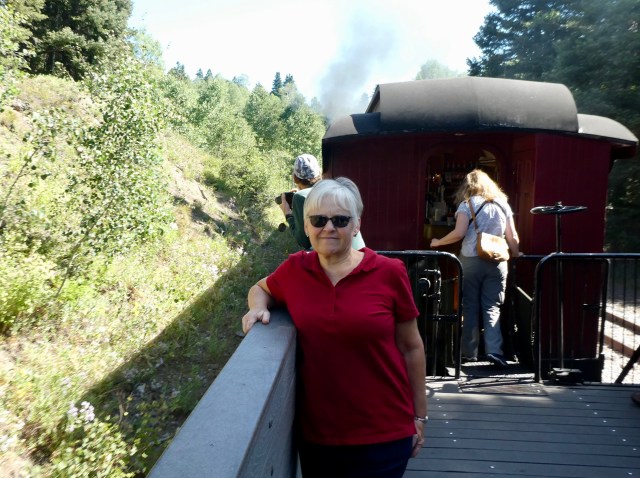
 At Cumbres Pass “station” eight people from our car disembarked.
 This is Tanglefoot Curve.
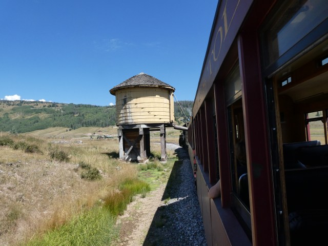
 Two and a half hours into our journey we approached Osier.
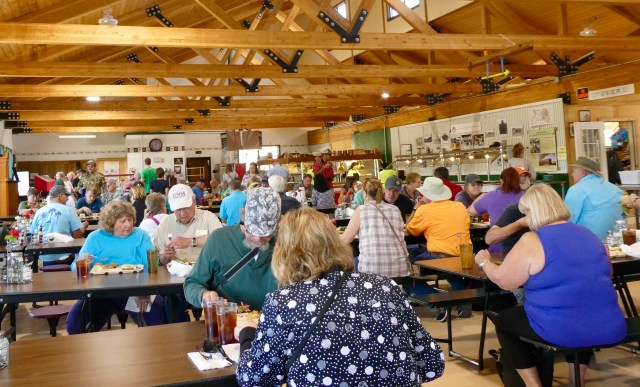
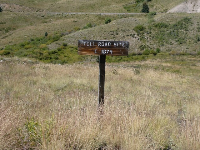 Osier used to be a toll station on the road from Conejos to Chama.
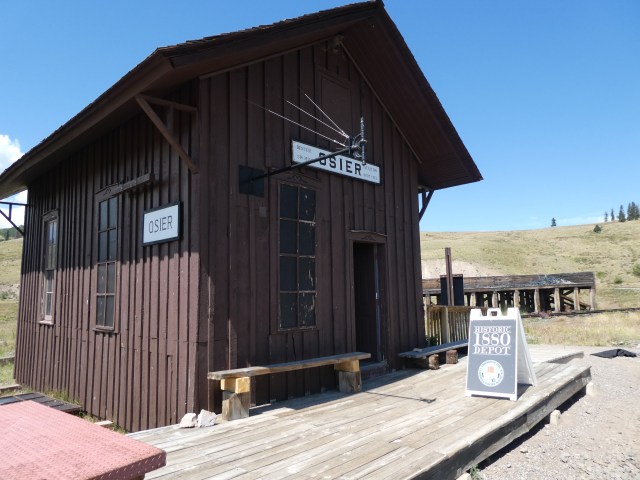
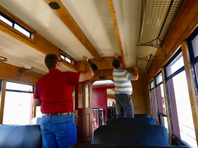 When we boarded the train to continue on a bird was trapped in our car.
 We traveled through the Toltec Gorge, 600 feet above the Rio de Los Pinos River.
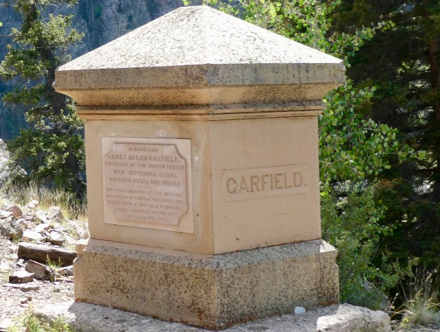 Just west of the Rock Tunnel we saw a Garfield monument.
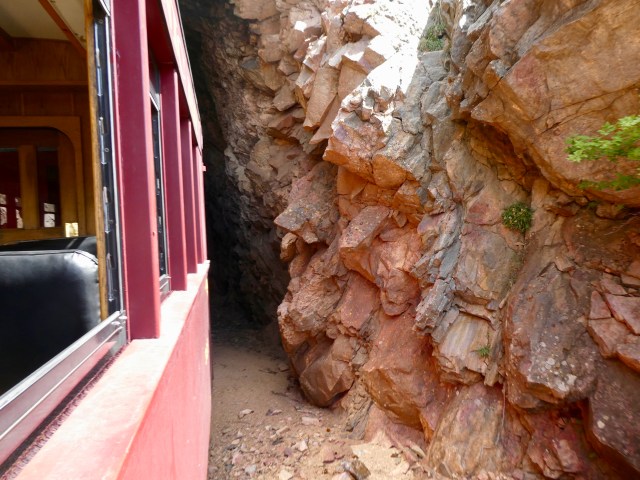 We entered the tunnel, bored through 360 feet of solid rock – in 1881.
 A second tunnel, Mud Tunnel, required wooden supports over the entire 342 foot length.
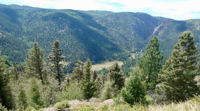 Throughout the day we enjoyed seeing houses and cabins in the wilderness.
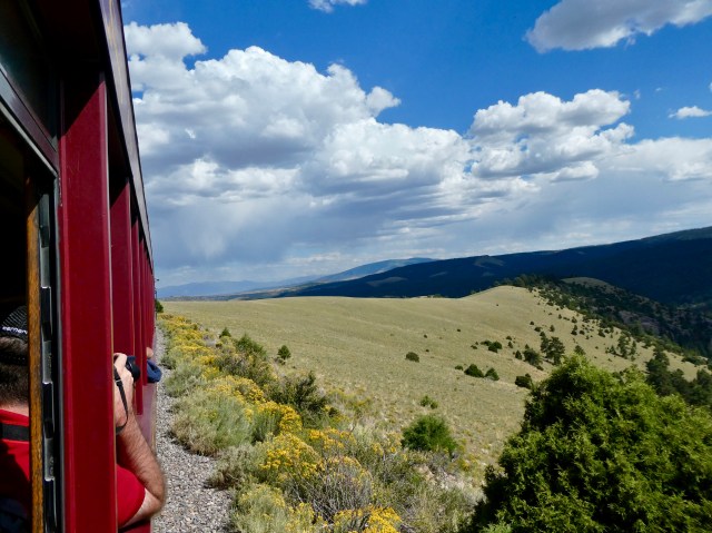
 We saw entering New Mexico (or Colorado) signs throughout the day!
 Sometimes a new sign appeared just a couple hundred yards down the track as the route looped from one side of the border to the other.
 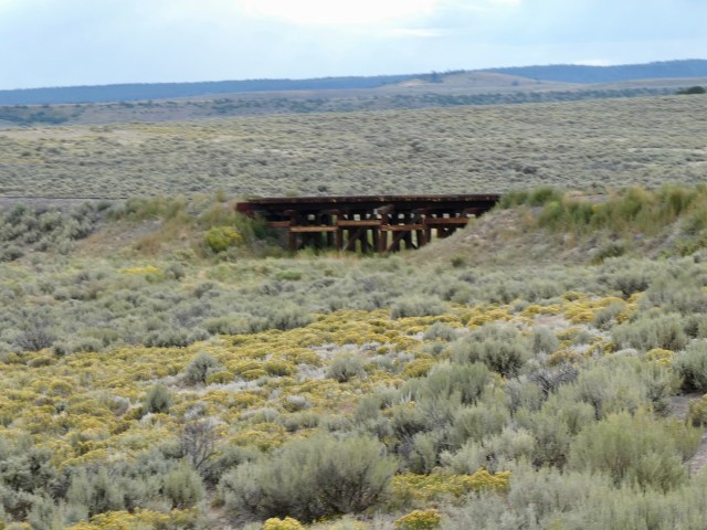 As we approached Antonito we saw Hangman’s Ferguson Trestle (Mr. Ferguson was hanged on it.)
 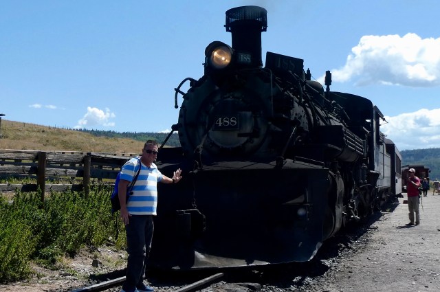 Randy and I have been fortunate to make seven or eight of these train trips. We have liked them all but agree that the Cumbres & Toltec Scenic Railroad is our favorite.
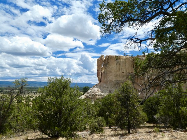
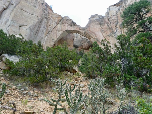
 El Morro, this large sandstone bluff, sat on the main east-west route for several people groups.
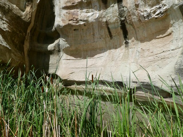
 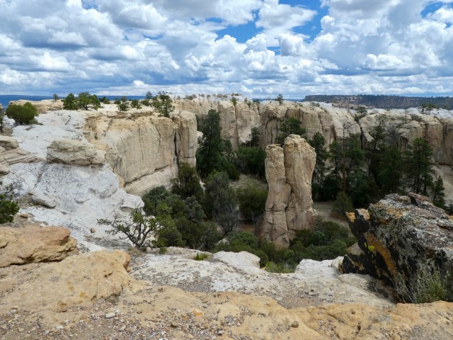 It wasn’t the rock promontory, but the oasis pool at the base that was the reason for many to stop and rest a spell.
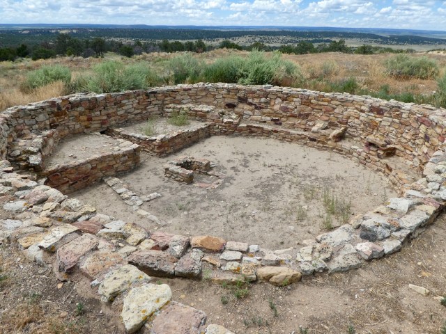 Zuni forefathers, part of the southwest puebloan culture,
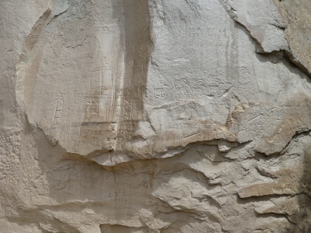
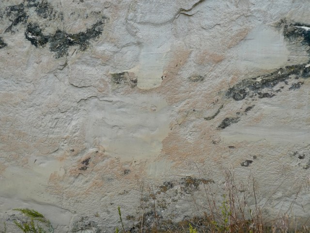
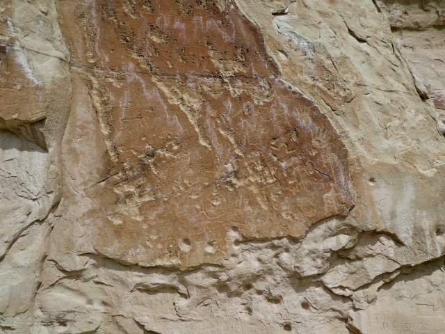 Petroglyphs in the sandstone bluff are the earliest carvings.
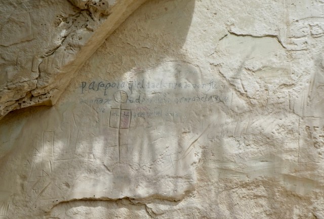
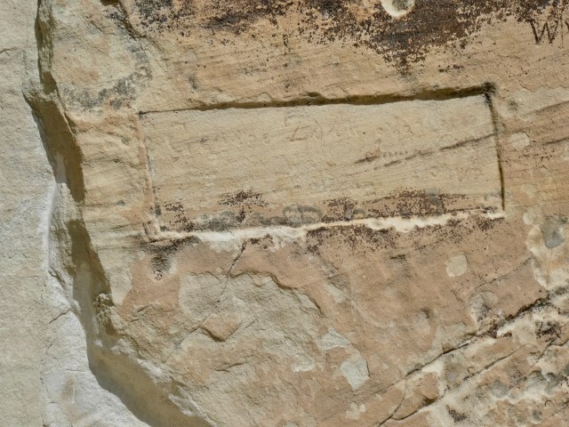
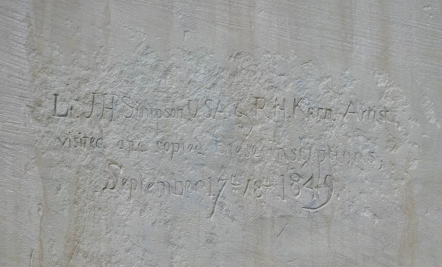 Named “Inscription Rock” by the Anglo-Americans, Army Engineer Lt. James H. Simpson and accompanying artist Richard Kern came to document the inscriptions.
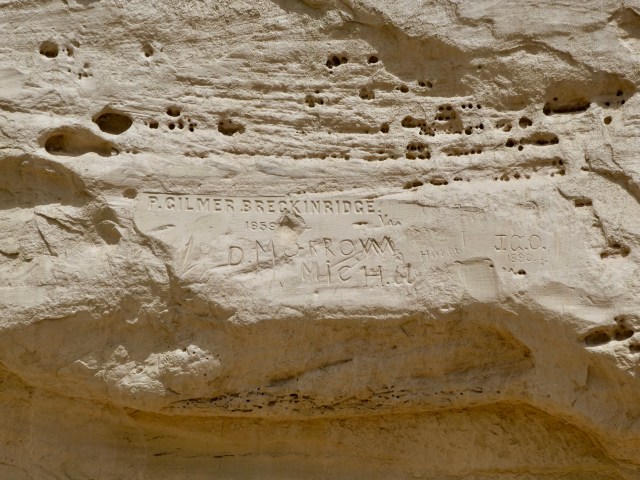
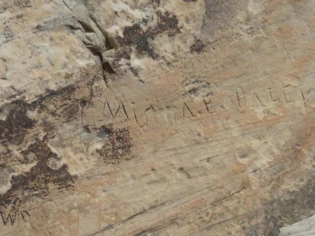 Emigrants to California and railway survey groups added inscriptions in the last half of the nineteenth century.
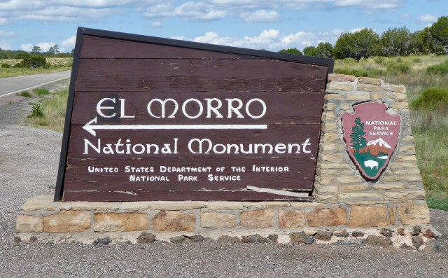 El Morro was named a National Monument in 1906, one of the original four designated
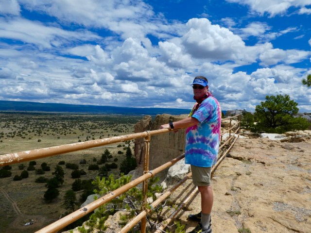
 A stop at the visitor center gives you an introductory video, expert advice and a loaner trail guide.
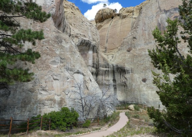
 Nature will have its way with sandstone but this cut is so precise it looked purposeful. Alas, no -it was just the way the rock broke and fell.
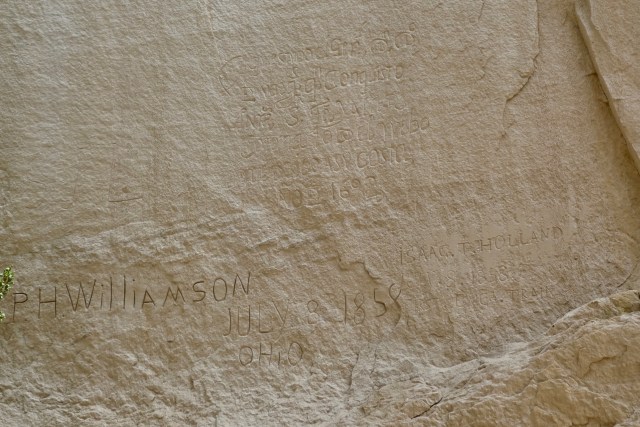

 Several monument administrators have done what they thought was best to try and preserve the inscriptions that will eventually be lost to nature. Cutting around inscriptions to move water flow away was attempted.
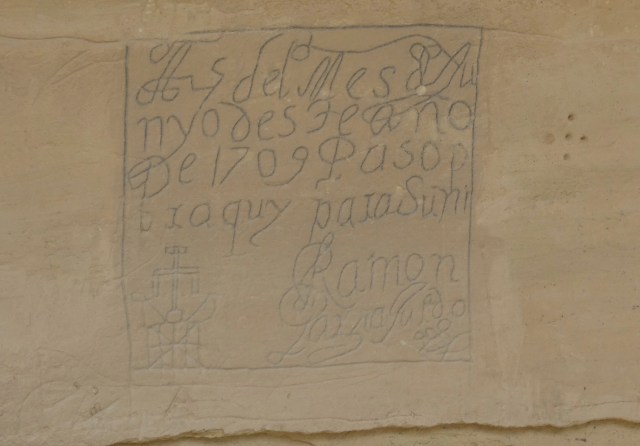
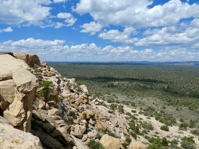
 After viewing the signatures near the base of the rock, we followed the trail up to the mesa.
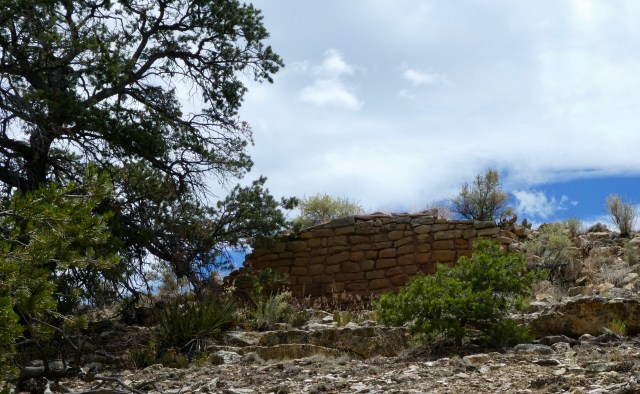
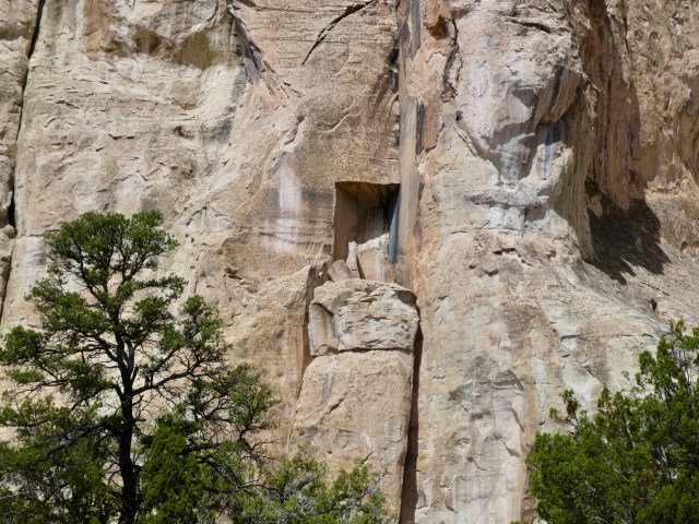
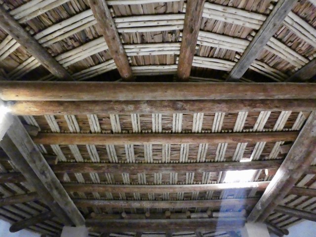
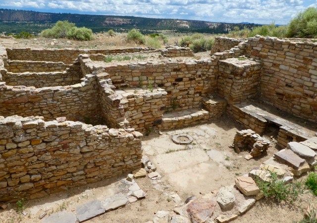 We saw a second set of ruins that are being preserved and are accessible.

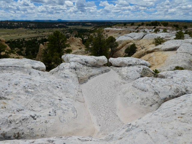
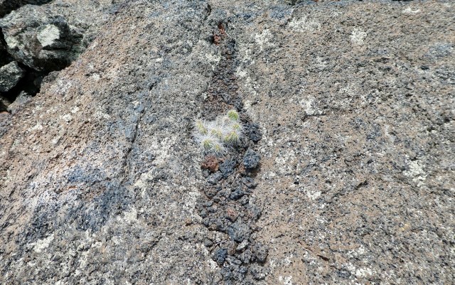
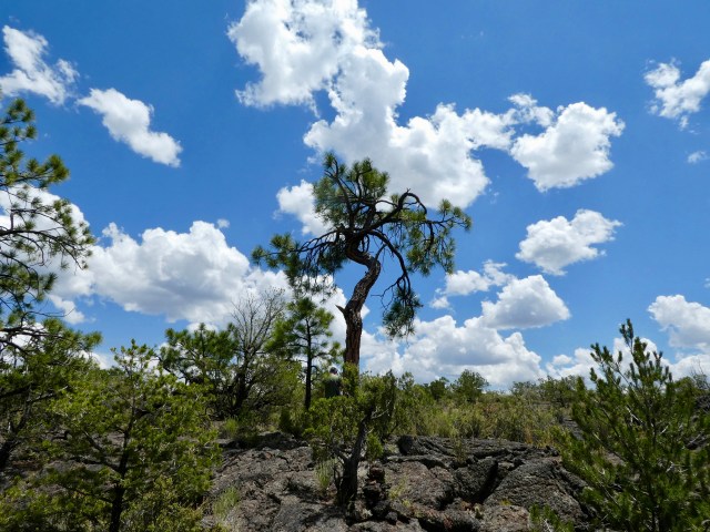
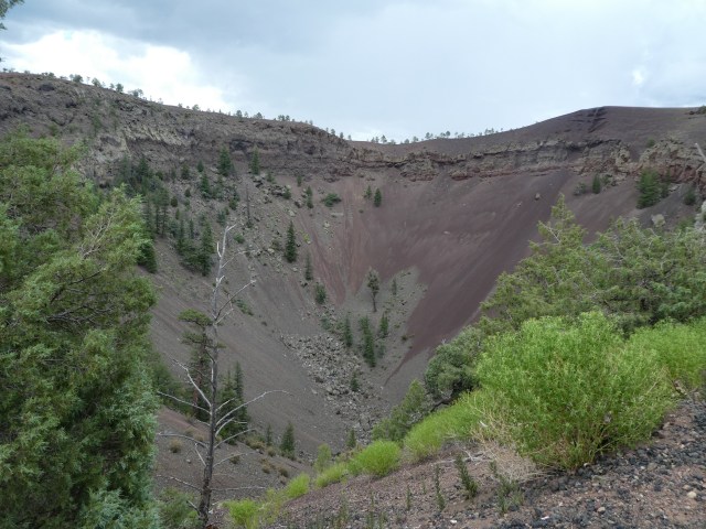
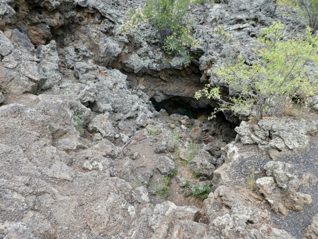
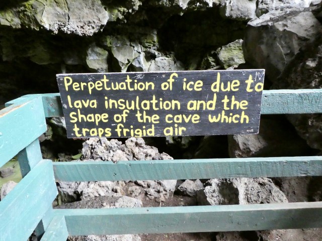
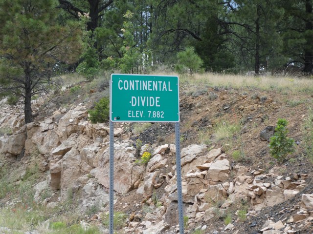
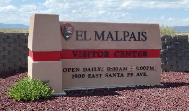 Our third NM in New Mexico was El Malpais National Monument.
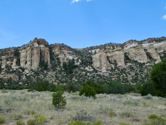

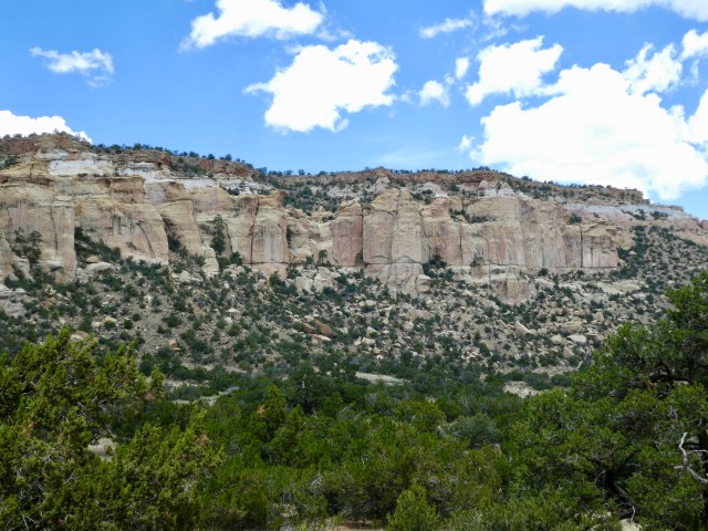
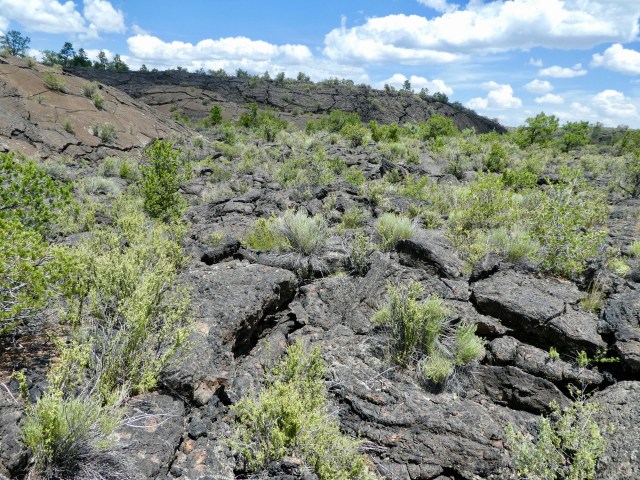
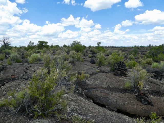
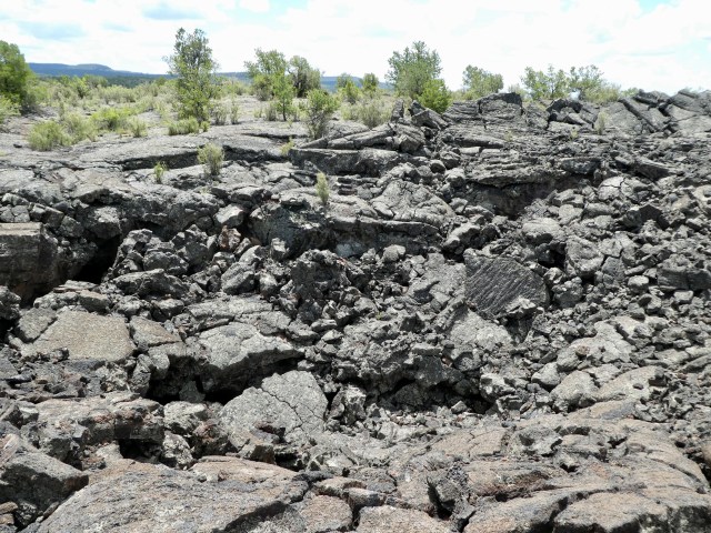

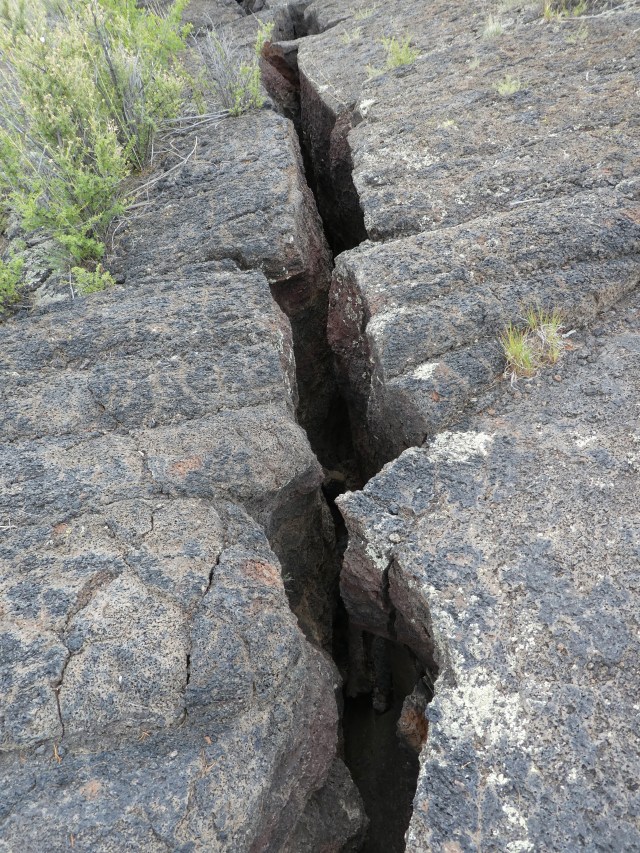
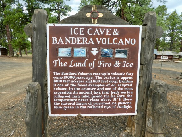
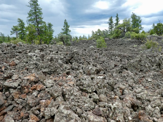 The site is privately owned, originally purchased for raising sheep. That is hard to imagine. The same family maintains ownership and is now in its second generation as a tourist site.
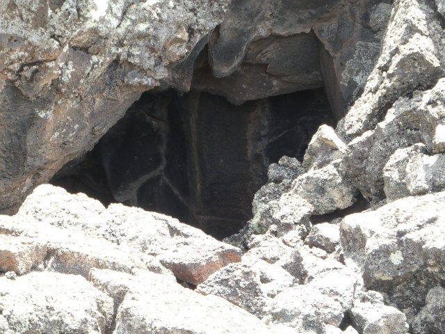
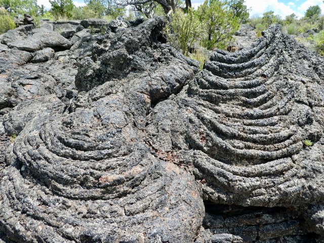
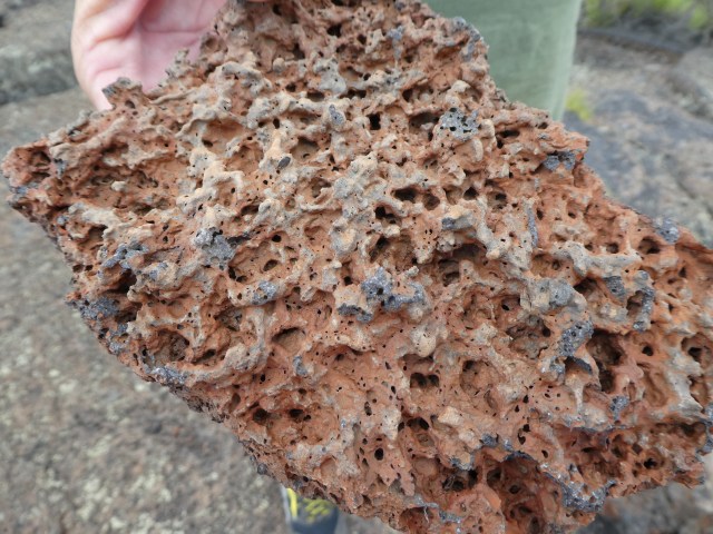
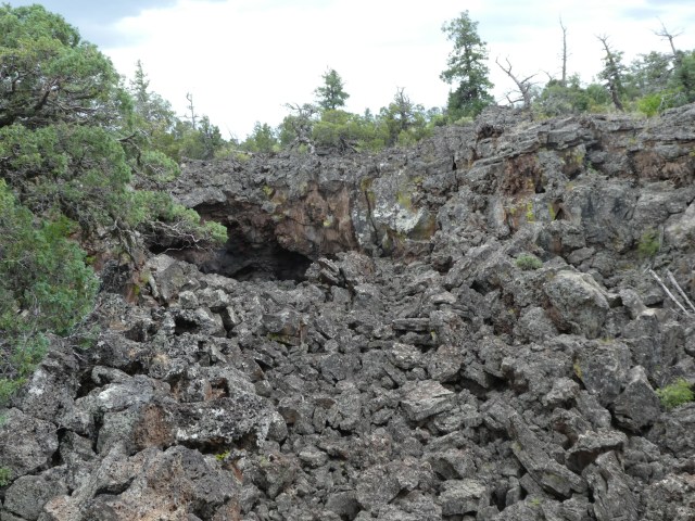
 This is a spattercone, formed when a minor vent formed in the molten lava.
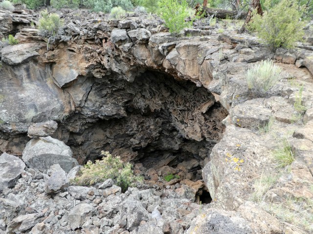


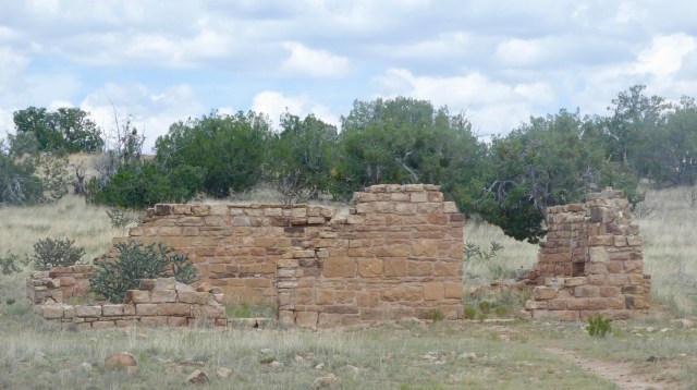
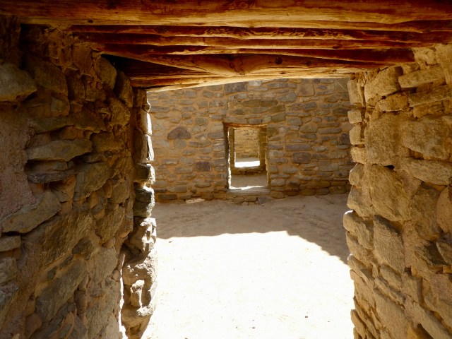
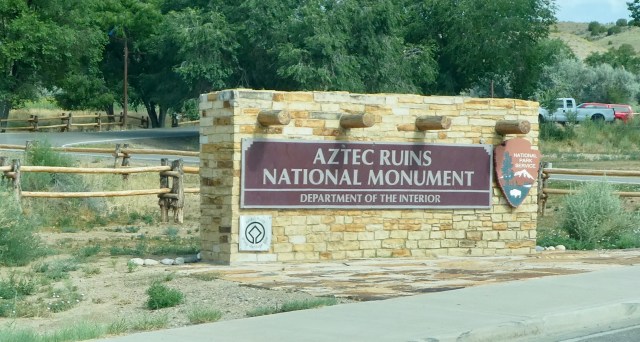 We almost didn’t go to Aztec Ruins.
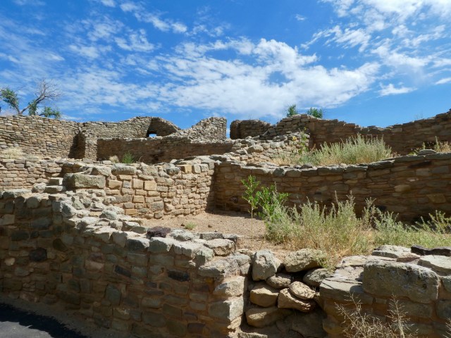 To be clear, the Aztecs were not here.
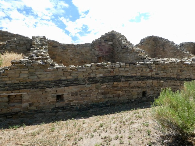
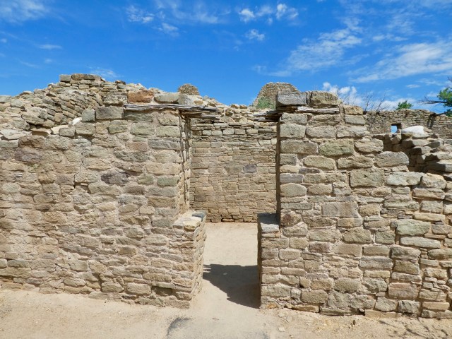
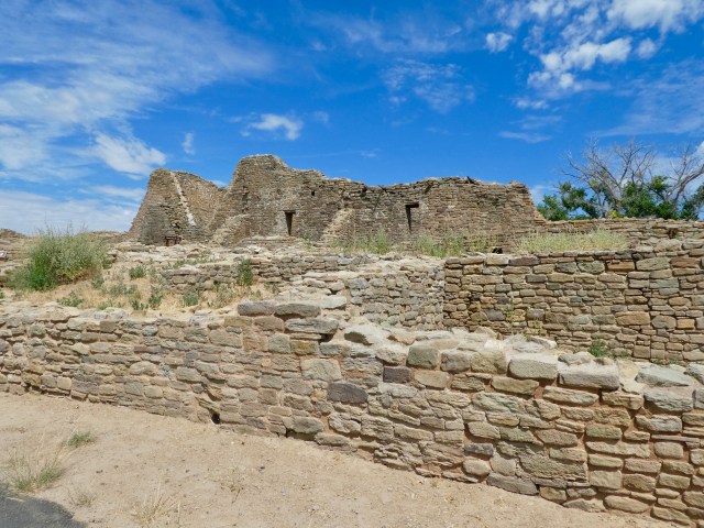
 Anthropologist Lewis Morgan investigated the site in 1878 and estimated 25% of the wall and room stones had been taken by area settlers for building materials.
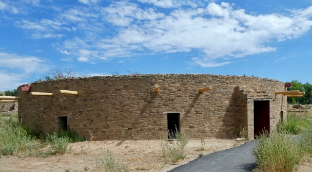 In 1916
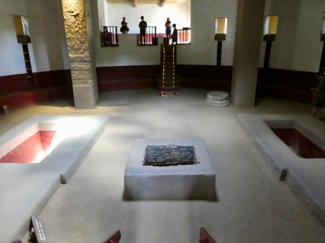
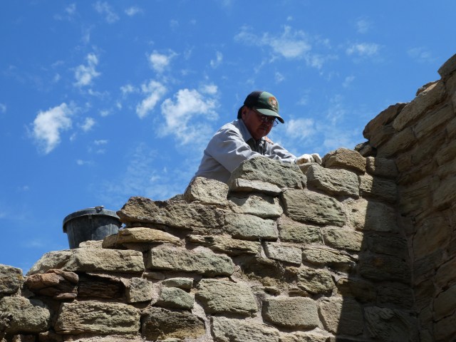 Today the National Park system oversees the security and preservation of the site.
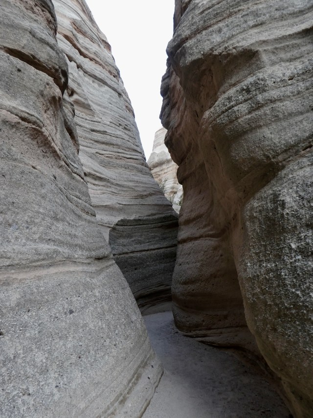
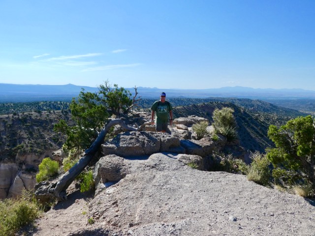
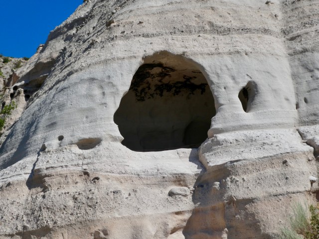
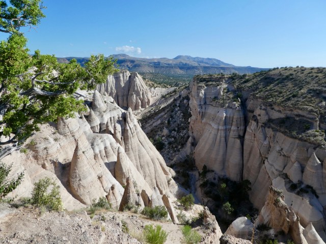
 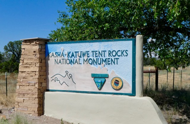 Kasha-Katuwe Tent Rocks National Monument is managed by the BLM with the Pueblo de Cochiti people.
 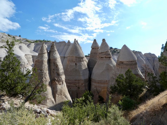 Cone shaped rocks were formed by successive volcanic eruptions occurring six to seven million years ago.
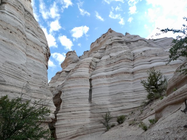

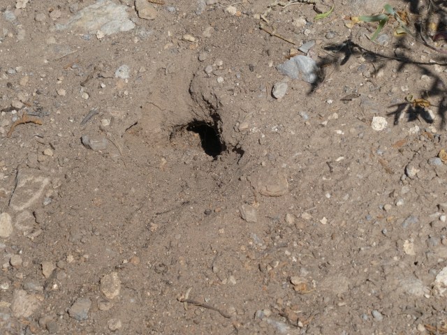
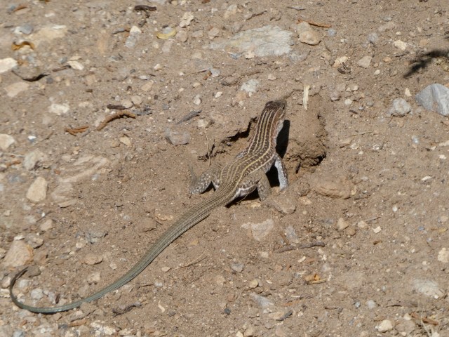 Hiking at altitude was difficult and we liked any excuse to pause. This guy went across the trail ahead of us and proceeded to dig his tunnel entrance while we watched.
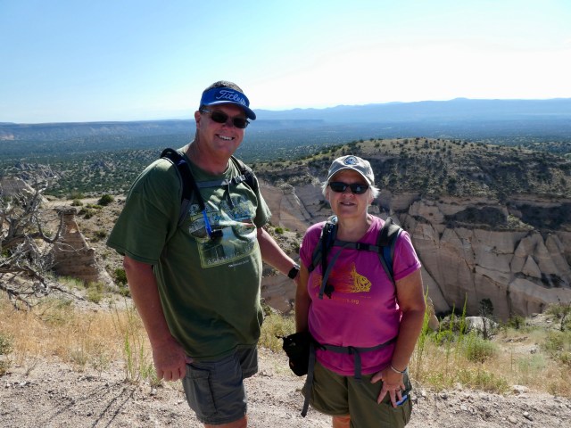
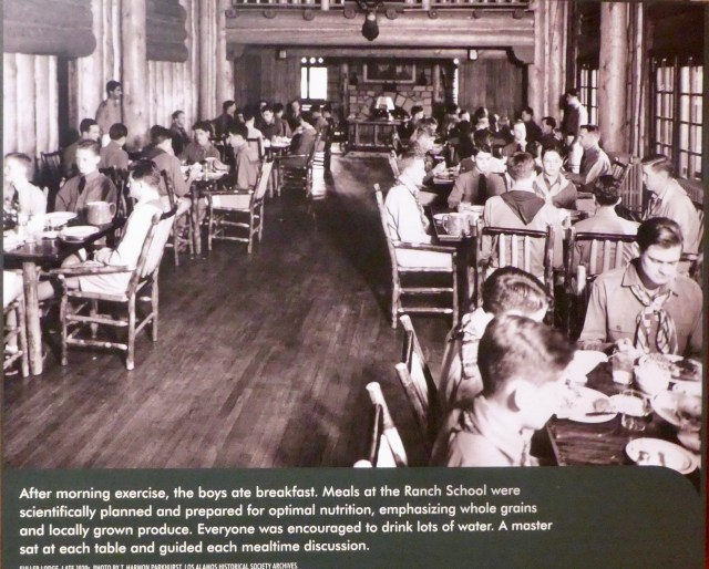 The site of the Los Alamos Ranch School, an exclusive boys boarding school located in the New Mexico wilderness was chosen for the lab.
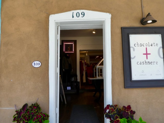 People joining the Manhattan Project checked in at 109 East Palace in Santa Fe. (Still there but now a chocolate shop.) From there they got assistance getting “up the hill” to the project site. The only road in was precarious.
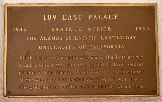
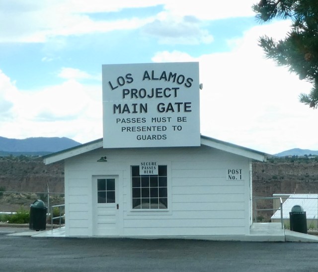 There was no town of Los Alamos, only the lab.
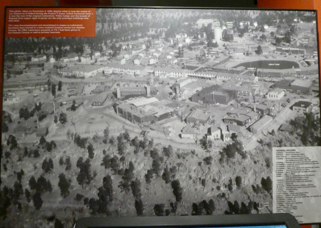 The make-shift Army post was not meant to be permanent and wasn’t designed for comfort.
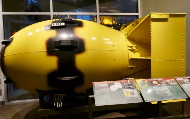
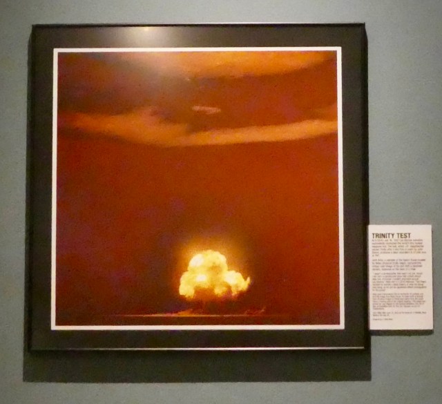 A plutonium implosion bomb was successfully detonated 200 miles away near Alamegordo at 5:29 am on July 16, 1945.
 The flash was so bright that it was visible to wives watching for “something” through the windows of a home on Bathtub Row at Los Alamos. (Bathtub Row houses were former faculty homes at the boys school, then given to the most important scientists, and were the only houses nice enough to have bathtubs.)
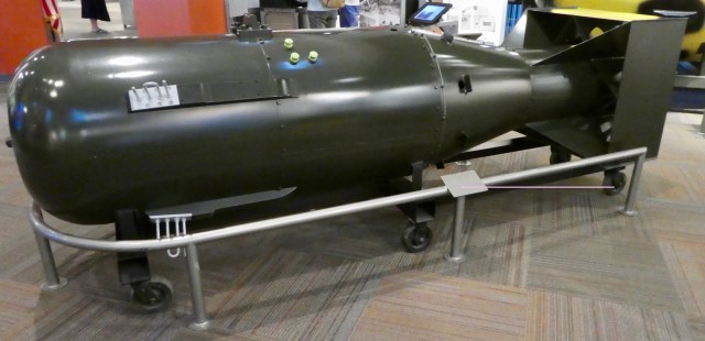
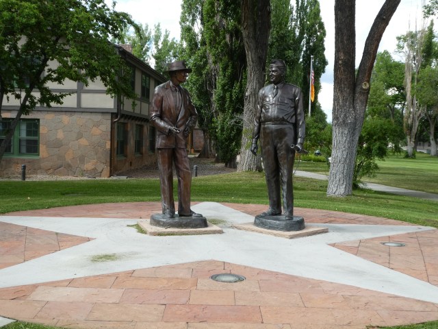
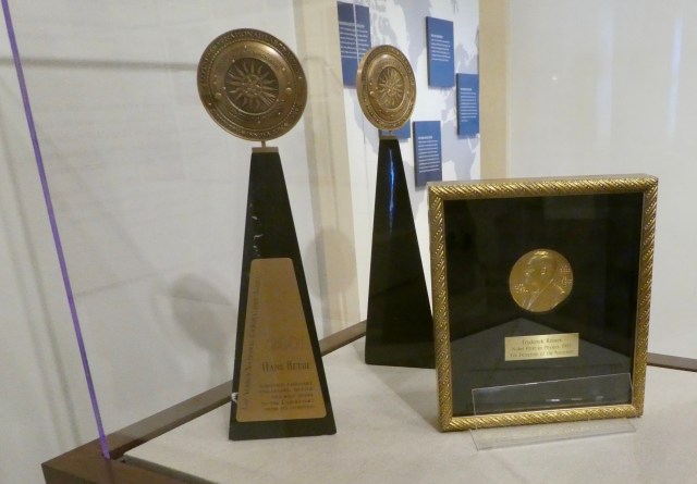 Past and current lab employees have earned a number of Nobel prizes (right).


 Our history stop was at San Miguel Church, the oldest church structure in the United States, built in 1610.
  The original adobe walls still exist under the stucco exterior.


 Gravel parking lot campgrounds are not our usual preference but this campground in Farmington had purpose.
  The torn vinyl required only glue and Randy fixed that right away.


 He was working on the toilet when I laid down and took a nap.


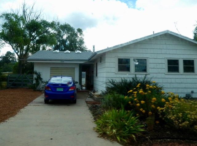
 We moved today and got settled in our new place near Santa Fe.
  Oh, did I say everything’s fixed…there is one more thing….A minor crack appeared in the desk top a couple of years ago. It has split and come together repeatedly as we have moved within different humidity levels. It has been a cosmetic problem bothering only me. Since we now live in the hot dry desert, the minor crack is now a cavern on the surface of the desk.
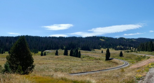
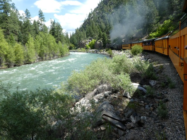
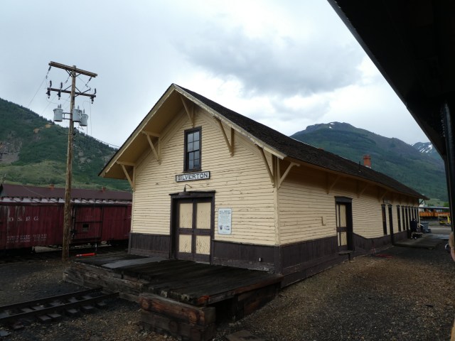
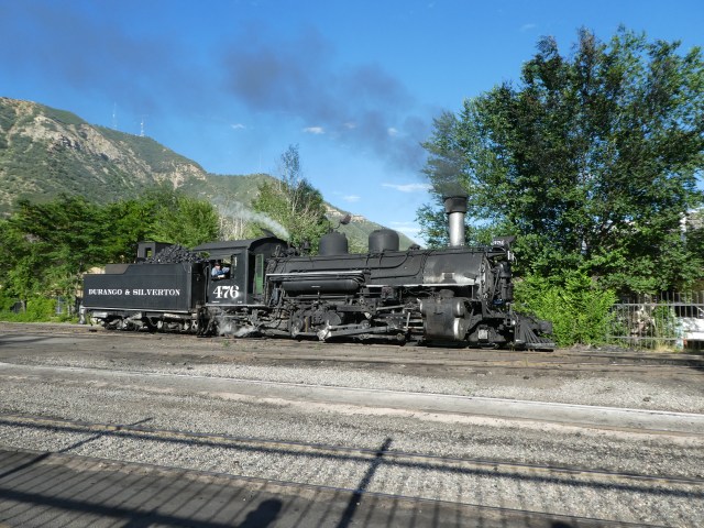 Our destination was the Durango & Silverton Narrow Guage Railroad, D&SNG, built 1881-82 to transport supplies north and mining ore south between Durango and Silverton.
  When mining became less profitable after World War II the train’s future was at risk.
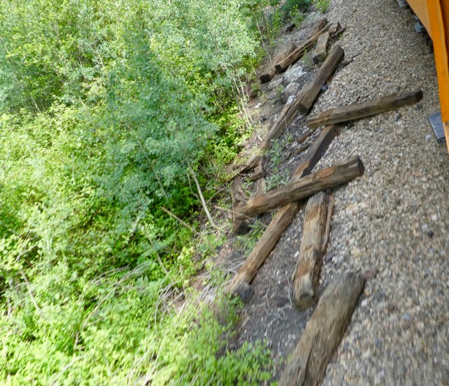 Over time, disrepair and neglect threatened the rail line again.
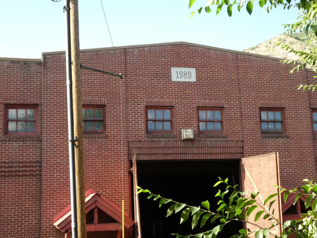 In 1989 a fire swept through the round house destroying infrastructure and damaging locomotives and cars.
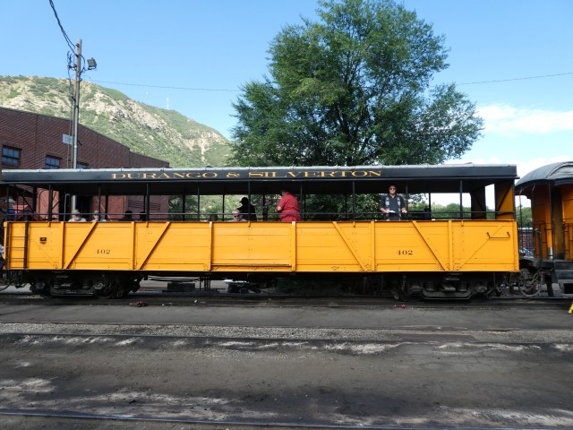 There are several options to ride, all with assigned seating.
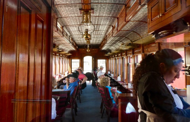
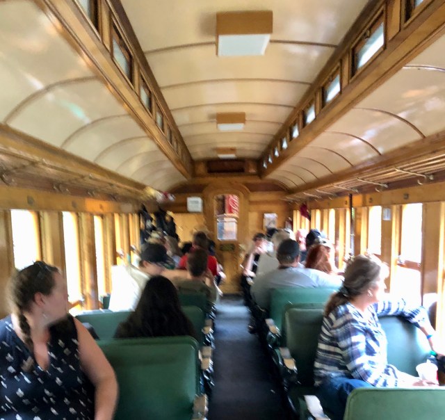
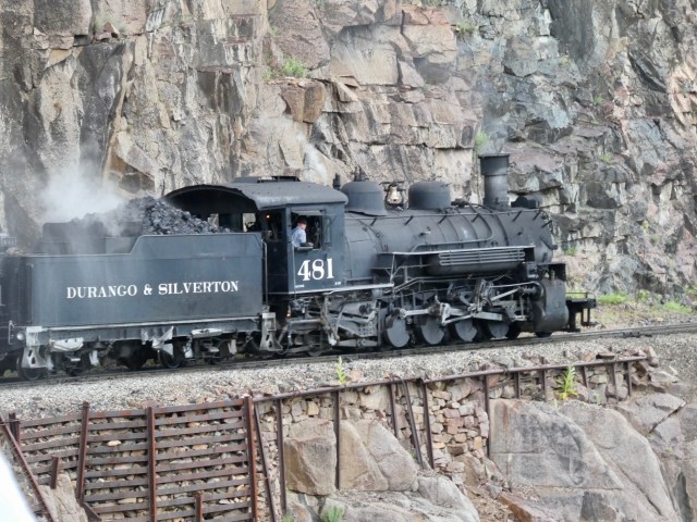 Our locomotive was #481, a Baldwin-K36 class, one of ten built in 1925 and numbered in series from 480-489. Nine of the ten are still out there.
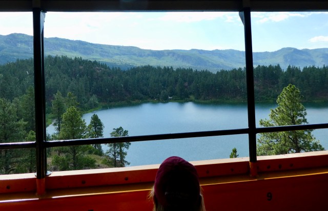 Passengers on the other side of the car were pleased with their view as we began.
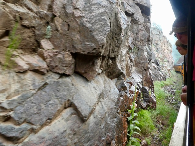
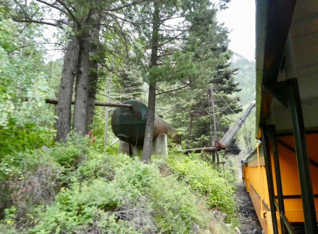
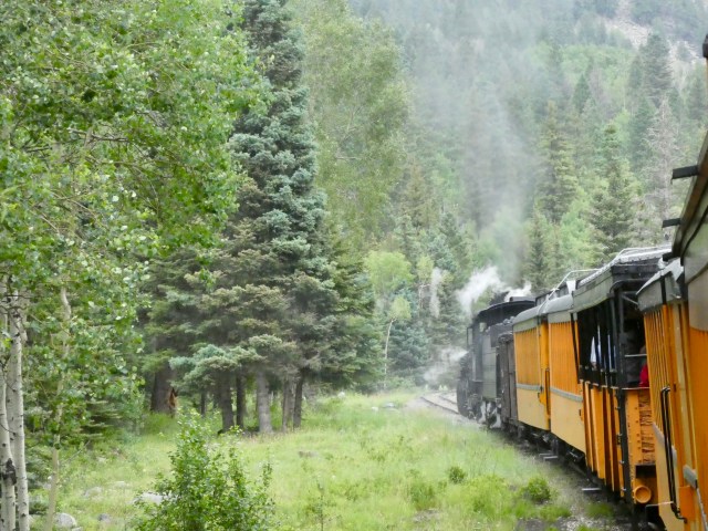

 Coal locomotives have risk of escaping cinders.
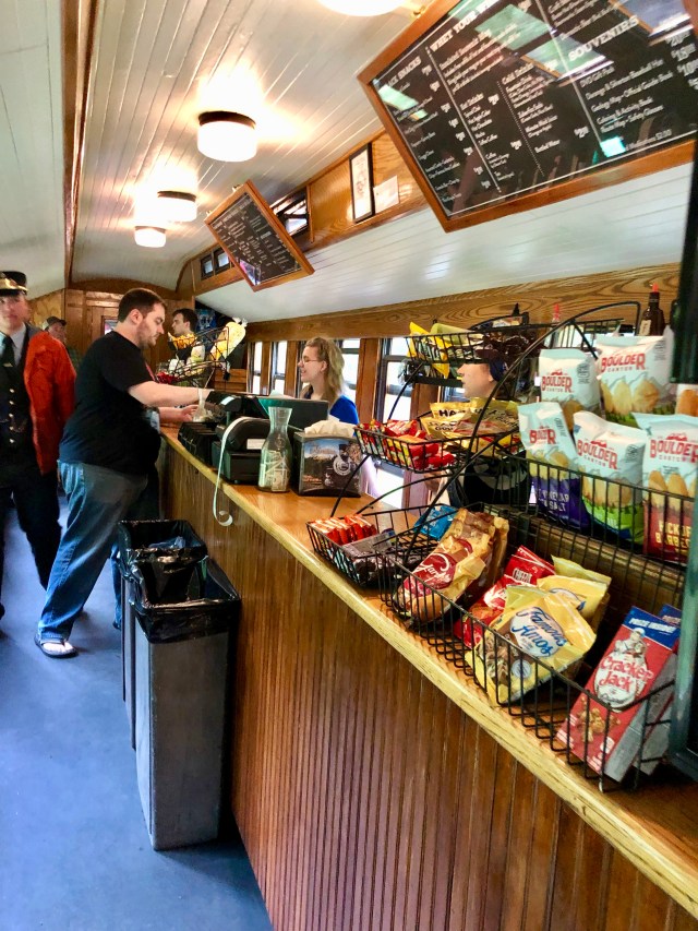
 After arrival, train guests are guaranteed 90 minutes before return departure.
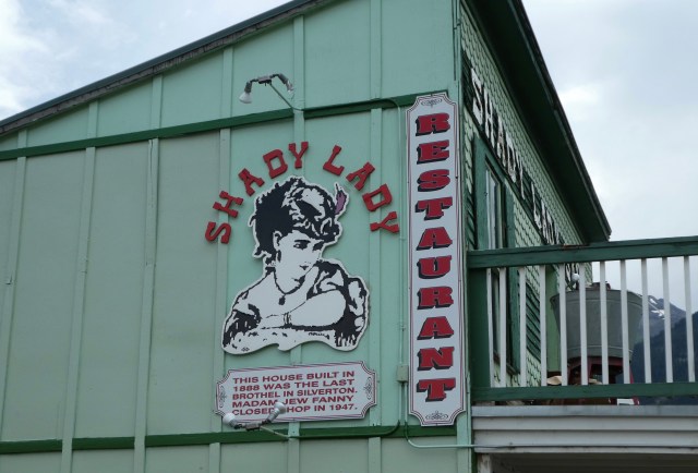
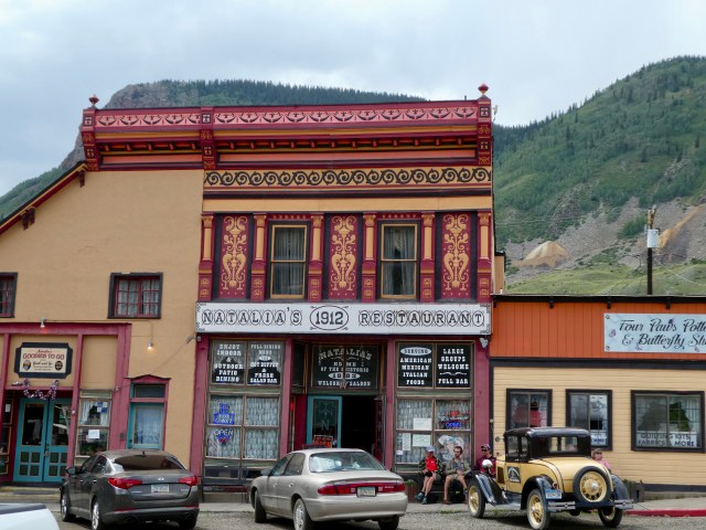
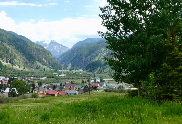
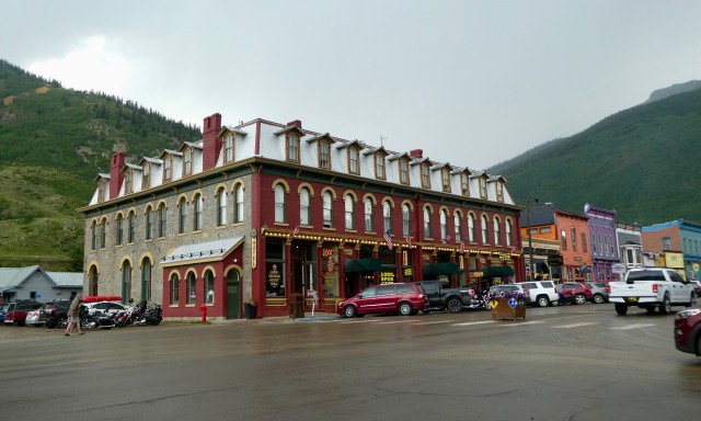 Hunger quenched we set about exploring.
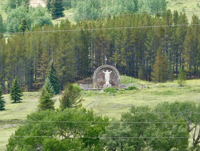 We saw a shrine on the hill and went part way up.
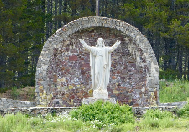
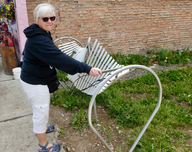 In town we found Freenote Harmony Park.
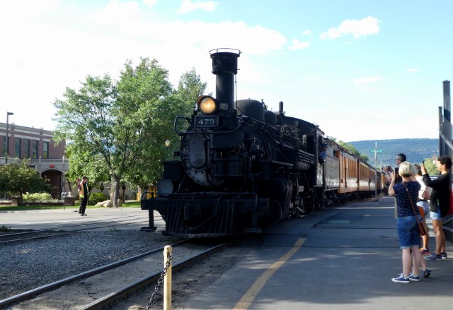
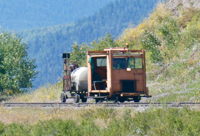
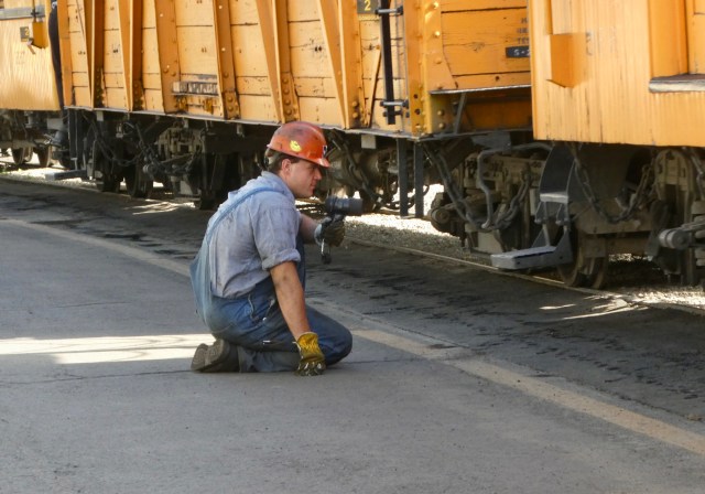 We watched as workers knelt on either side and peered under the train as it went by.
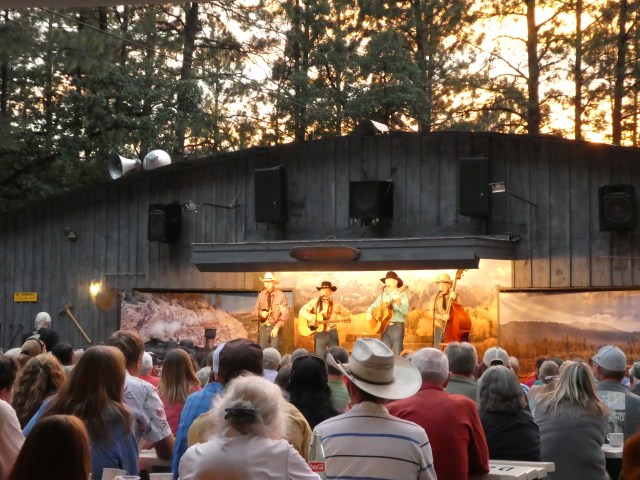 Next up was the BarD Old West Music Show and Chuckwagon Supper.
